
Fort Assinniboine facts for kids
Quick facts for kids Fort Assinniboine |
|
|---|---|
| Hill County, six miles southwest of Havre, Montana | |

Company Officers' Quarters at Fort Assinniboine
|
|
| Site information | |
| Controlled by | United States |
| Site history | |
| Built | 1879 |
| In use | 1879–1911 |
| Battles/wars | Cree Campaign |
|
Fort Assinniboine
|
|

Location in Montana

Location in the United States
|
|
| Nearest city | Havre, Montana |
| Area | 160 acres (65 ha) |
| Built | 1879 |
| Architect | Lee, Col. J.G.C.; Devlin, L.K. |
| NRHP reference No. | 89000040 (original) 100002250 (increase) |
| Significant dates | |
| Added to NRHP | May 31, 1989 |
| Boundary increase | April 2, 2018 |
Fort Assinniboine was a large fort built by the U.S. Army. It was located in north central Montana. The fort was built in 1879 and used until 1911.
One famous group of soldiers stationed there were the 10th Cavalry "Buffalo Soldiers". These were African-American soldiers. The fort was closed because the Indian Wars had ended. The Army decided it was no longer needed.
Later, in 1916, part of the fort's land was given to the Rocky Boy's Indian Reservation. This reservation was for the Chippewa people. They had lost their traditional lands. Some Cree and Metis people, who were refugees from Canada, also settled there.
Contents
Why Fort Assinniboine Was Built
After the Battle of the Little Bighorn in 1876, the U.S. Army wanted to protect its borders. General Phil Sheridan suggested building a fort near the Milk River. This fort would help guard against possible attacks. These attacks might come from Sioux groups led by Chief Sitting Bull. Some Nez Perce people were also in Canada.
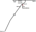
The fort was built in Hill County. It is about six miles southwest of Havre. The fort was named after the Assinniboine people. Luckily, neither the Sioux nor the Nez Perce in Canada ever attacked across the border.
Life at the Fort
Fort Assinniboine was a very large military base. At its biggest in 1880, it covered about 704,000 acres. This is like 1,100 square miles! Later, its size was made smaller.
At its busiest, over 750 officers and soldiers lived there with their families. The fort had 104 buildings. This made it one of the biggest forts ever built in the United States.
The Buffalo Soldiers
The 10th Cavalry "Buffalo Soldiers" were an important part of Fort Assinniboine. These brave African-American soldiers served during the Indian Wars.
They also fought in the Spanish–American War. In 1898, they supported Roosevelt's "Rough Riders" at the Battle of San Juan Hill in Cuba. Many people said that the Rough Riders would not have won without the Buffalo Soldiers.
The Fort Closes
By the early 1900s, the Indian Wars were over. The Army decided Fort Assinniboine was no longer needed. So, in 1911, the fort was closed down.
At the same time, a Chippewa leader named Asiniiwin, also known as Rocky Boy, asked the government for land. His people had been forced out of their homes further east. Many Chippewa and Cree people had settled on the fort's land. The Cree had come from Canada after a rebellion there.
In 1916, the government agreed to create a reservation for the Chippewa. A part of Fort Assinniboine was given to the Rocky Boy's Indian Reservation. This reservation was named in honor of Chief Rocky Boy. It is the smallest reservation in Montana.
Most of the old fort buildings were taken apart. Settlers used the materials to build their own homes. A few buildings still stand today. They are used as a research station for Montana State University - Bozeman. It is also a historical site.
A part of the reservation, near Beaver Creek, became a large park. It was first a national park. Then it was given to the city of Havre, Montana. Now, it is called Beaver Creek Park. It is the largest county park in the United States, with 10,000 acres.
Visiting Fort Assinniboine
You can visit Fort Assinniboine today! The Havre Chamber of Commerce and the Hill County Museum have information for visitors.
During the summer (June 1 to September 1), you can find a tour guide. Tours are available Monday through Friday from 9 AM to 5 PM. On Saturdays and Sundays, tours are at noon and 5 PM. You can also arrange tours by appointment. The fort is listed on the National Register of Historic Places.
Images for kids
-
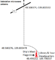
How to get to Fort Assinniboine from Highway 87
-
Local dirt roads around Fort Assinniboine


