
Havre, Montana facts for kids
Quick facts for kids
Havre, Montana
|
|
|---|---|
|
City
|
|

View of Havre looking south to the Bears Paw Mountains
|
|
| Nickname(s):
Heart of the Hi-Line
|
|

Location of Havre, Montana
|
|
| Country | United States |
| State | Montana |
| County | Hill |
| Area | |
| • Total | 3.71 sq mi (9.61 km2) |
| • Land | 3.71 sq mi (9.61 km2) |
| • Water | 0.00 sq mi (0.00 km2) |
| Elevation | 2,562 ft (781 m) |
| Population
(2020)
|
|
| • Total | 9,362 |
| • Density | 2,524.13/sq mi (974.57/km2) |
| Time zone | UTC−7 (Mountain [MST]) |
| • Summer (DST) | UTC−6 (MDT) |
| ZIP code |
59501
|
| Area code(s) | 406 |
| FIPS code | 30-35050 |
| GNIS feature ID | 2410715 |

Havre (pronounced HAV-er) is a city in Montana, United States. It's the biggest city and the main center of Hill County. Havre is often called the "crown jewel of the Hi-Line" because it's a very important city in that region. People say it got its name from the city of Le Havre in France. In 2020, about 9,362 people lived there.
Contents
History of Havre
Havre became an official city in north central Montana in 1893. It was first built to be a major service center for the Great Northern Railway. This railway was built by James J. Hill. Havre was a perfect spot because it was halfway between Seattle and Minneapolis-St. Paul. You can see a statue of James J. Hill near the Havre Amtrak station today. It reminds everyone how much his railroad helped Havre and Montana grow.
How Havre Got Its Name
The town was first called Bullhook Bottoms. The people living there had meetings to pick a new name. The first settlers got to make the final choice. Because many people had French backgrounds, they decided to rename the town Havre.
Simon Pepin: The "Father of Havre"
Simon Pepin (1840–1914) is known as the "Father of Havre." He was born in Quebec, Canada, and moved to Montana in 1863. Simon Pepin was a contractor who provided supplies for building important forts like Fort Custer and Fort Assinniboine. He bought ranch land near Fort Assinniboine. When James J. Hill built the Great Northern Railway, he put his train repair shops on land that Simon Pepin owned in Havre. Simon Pepin helped Havre's economy grow a lot through his cattle, real estate, and banking businesses.
Havre's Role in Montana
Havre is the eighth-largest city in Montana. It's also the biggest city in the Montana part of the Hi-Line. The next bigger city, Great Falls, is about 120 miles (193 km) south. This means Havre is a key place for medical care and businesses for people living along the Hi-Line. U.S. Highway 87 ends in Havre, and U.S. Highway 2 runs through the city as its main street.
The biggest employers in Havre are the Northern Montana Hospital, Montana State University – Northern, and the BNSF Railway. For most of the 1900s, the BNSF Railway was the main employer. However, the company reduced its number of workers in Havre in the 1990s. The Milk River flows through the town, and you can see the Bear's Paw Mountains to the south.
Havre Beneath the Streets
If you look closely at some sidewalks downtown, you might see small grids of purple squares. These are skylights for an amazing underground area built over a hundred years ago! This underground space has been home to a Chinese laundromat, a saloon, a drugstore, and even secret rooms used for smuggling alcohol during a time called Prohibition. During Prohibition, it was illegal to make or sell alcohol.
In 1904, a big fire destroyed Havre's business district. While new brick buildings were being built above ground, many legal businesses moved into the underground area. Today, this underground area is called "Havre Beneath the Streets" and is a popular place for tourists to visit.
Wahkpa Chu'gn Buffalo Jump
The Wahkpa Chu'gn buffalo jump, also known as a bison kill site, is located near the Holiday Village Shopping Center in Havre. It's over 2,000 years old and is one of the largest and best-preserved buffalo jumps anywhere! Long ago, Native Americans would guide bison over the edge of a cliff. This would kill or badly injure the animals, making it easier for the Native Americans to skin them and preserve the meat. Today, the buffalo jump is an important archaeological site and a small tourist attraction.
The buffalo jump is on the edge of the Havre Badlands. This is a special land formation along the Milk River. You can find small fossils here, like seashells and petrified wood, in the limestone rock.
Fort Assinniboine
About 6 miles (10 km) southwest of Havre is Fort Assinniboine. This fort was one of Montana's main military posts from 1879 through the Prohibition era. The United States used it to protect against possible attacks from Native Americans and to stop people from crossing the border from Canada without permission. At its busiest, the fort had 489 soldiers and 104 buildings.
Bear's Paw Battlefield
Also near Havre is the Bear's Paw Battlefield. This is where the Battle of Bear Paw took place. The Nez Perce people were attacked and defeated by the U.S. Cavalry here. Their leader, Chief Joseph, surrendered to the Cavalry. He gave a very famous speech that ended with the powerful words, "From where the sun now stands, I will fight no more forever."
Havre's Location and Climate
Havre is located at 48.5454 degrees North latitude and 109.6775 degrees West longitude. The city covers a total area of about 3.28 square miles (8.50 square kilometers), and all of it is land.
Weather in Havre
Havre has a semi-arid climate. This means it has long, cold, and dry winters. Summers are hot during the day but cool at night. Winter weather can change a lot. Sometimes it gets extremely cold when Arctic air comes from Canada. Other times, warm chinook winds can make temperatures much warmer than freezing. For example, the coldest month ever recorded was January 1916, which averaged -13.3°F (-25.2°C). But February 1954 averaged 37.1°F (2.8°C)! The hottest temperature ever recorded in Havre was 111°F (44°C) on August 5, 1961. The coldest was -57°F (-49°C) on January 27, 1916.
People of Havre
As of the 2010 census, there were 9,310 people living in Havre. There were 3,900 households and 2,293 families. The city had about 2,838 people per square mile (1,096 per square kilometer).
Most people in Havre are White (81.6%). About 13.0% are Native American, and smaller numbers are African American, Asian, or from other backgrounds. About 2.5% of the population is Hispanic or Latino.
About 30.1% of households had children under 18 living with them. The average age in the city was 33.9 years old. About 25.1% of residents were under 18, and 13.4% were 65 or older. The population was almost evenly split between males (49.8%) and females (50.2%).
Getting Around Havre

Havre is located on the Northern Transcon railway line of the BNSF Railway. Amtrak's Empire Builder train stops at the Havre station every day. The Havre City–County Airport is a public airport located 3 miles (5 km) west of Havre. North Central Montana Transit offers some bus services to nearby towns like Great Falls, Montana, Rocky Boy's Indian Reservation, Harlem, Montana, and Fort Belknap, Montana.
Local Media
Radio Stations
- KOJM AM 610/FM 98.3 (Plays Classic Hits)
- KNMC FM 90.1 (College Radio)
- KPQX FM 92.5 (Country Music)
- KXEI FM 95.1 (Christian Music)
- KRYK FM 101.3 (Hot Adult Contemporary Music)
Television Stations
You can watch TV stations from the Great Falls area in Havre:
Satellite TV and cable services are also available in Havre.
Newspapers
The Havre Weekly Chronicle is a local newspaper published every week. It has a circulation of 3,500 papers. You can also read it online if you have a subscription, and some content is free. The larger Great Falls Tribune newspaper is also available in most areas.
Education in Havre

Havre Public Schools serve the city. They include Havre High School, S.U.N.S. Alternative High School, Havre Middle School, and three elementary schools.
For higher education, students can attend the Montana State University-Northern campus.
Havre also has a public library called the Havre-Hill County Library. There is one private school in the city, Saint Judes Thaddeus School, which is connected to the Catholic Church.
Fun Places to Visit in Havre

- LORAN-C transmitter Havre: A tall radio tower.
- Big Bud 747: The world's largest farm tractor!
- Wahkpa Chu'gn: A buffalo jump archaeological site where you can learn about how Native Americans hunted bison long ago.
- The Havre Underground: A cool tourist attraction that takes you on a tour of the historic underground city.
Famous People From Havre
Many interesting people have come from Havre, including:
- Philip Aaberg: A talented pianist and composer.
- Jeff Ament: A musician, famous as the bassist for the band Pearl Jam.
- Jacob Bachmeier: One of the youngest state lawmakers in the United States.
- Larry Heck: An expert in Artificial Intelligence (AI) and a co-founder of Microsoft Cortana.
- Marc Mariani: A former professional football player in the NFL.
- Jill McLain: Who was crowned Miss Montana USA in 2006.
- Karl Ohs: A former lieutenant governor of Montana.
- Flint Rasmussen: A professional rodeo clown.
- Brian Schweitzer: Who served as the governor of Montana from 2005 to 2013.
- Stan Stephens: Another former governor of Montana from 1989 to 1993.
- Jon Tester: The current U.S. senator for Montana.
- Mike Tilleman: A former professional football player in the NFL.
Images for kids
-
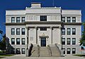
Hill County Courthouse in downtown Havre

See also
 In Spanish: Havre (Montana) para niños
