Bears Paw Mountains facts for kids
Quick facts for kids Bears Paw Mountains |
|
|---|---|

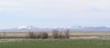
Bears Paw Mountains as seen from near Virgelle, Montana
|
|
| Highest point | |
| Peak | Baldy Mountain |
| Elevation | 6,916 ft (2,108 m) |
| Geography | |
| Country | United States |
| State | Montana |
| Range coordinates | 48°12.5′N 109°31.05′W / 48.2083°N 109.51750°W |
| Geology | |
| Age of rock | Late Cretaceous |
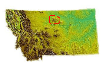
The Bears Paw Mountains are a group of mountains in North-Central Montana, USA. They are sometimes called the Bear Paw Mountains or Bearpaw Mountains. These mountains are about 10 miles (16 km) south of Havre, Montana.
The tallest point in the range is Baldy Mountain. It stands 6,916 feet (2,108 meters) above sea level. The Bears Paw Mountains stretch for about 45 miles (72 km). They form an arc between the Missouri River and the Rocky Boy's Indian Reservation.
What's in a Name?
People who live nearby often call these mountains the "Bearpaws." Native American names for the mountains include Waną́be (meaning "bear paws") and Daxpitcheeischikáate (meaning "bear's little hand"). Another name is ʔɔɔwɔ́hʔoouh, which means "there are many buttes."
Even though highway signs say "Bears Paw Mountains," you might also see "Bearpaw Mountains" or "Bear Paw Mountains" on older maps. The U.S. Geological Survey still uses "Bearpaw Mountains" in its official writings.
How the Mountains Were Formed
The main part of the Bearpaws is made of special rocks. These rocks were formed a very long time ago, during a period called the Eocene Epoch. They are igneous rocks, which means they were once hot, melted rock (magma) that cooled and hardened underground.
These mountains were once a huge center for volcanic activity. Some common types of igneous rocks found here are shonkinite, latite, and tinguatite.
The Cretaceous Bearpaw Formation is a layer of rock found in these mountains. This rock layer is named after the range itself.
A Bit of History
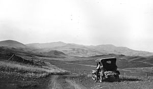
A famous Native American leader, Chief Joseph of the Nez Perce, surrendered near these mountains. This happened in October 1877, after a fight known as the Battle of Bear Paw. He surrendered to Colonel Nelson A. Miles in the foothills of the Bear's Paw Mountains.
Native American Legend
Native American stories explain how the mountains got their name. One legend tells of a hunter who was looking for deer to feed his family. He found a deer, but on his way back, a bear attacked him. The bear held the hunter down.
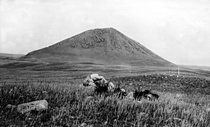
The hunter asked the Great Spirit for help. The Great Spirit sent lightning and thunder, striking the bear. The bear died, and its paw was cut off, freeing the hunter. If you look at Box Elder Butte, it is said to look like the bear's paw. Centennial Mountain, to the south, is said to look like a sleeping bear.
 | Emma Amos |
 | Edward Mitchell Bannister |
 | Larry D. Alexander |
 | Ernie Barnes |


