Hofors Municipality facts for kids
Quick facts for kids
Hofors Municipality
Hofors kommun
|
||
|---|---|---|
 |
||
|
||
 |
||
| Country | Sweden | |
| County | Gävleborg County | |
| Seat | Hofors | |
| Area | ||
| • Total | 448.27 km2 (173.08 sq mi) | |
| • Land | 411.11 km2 (158.73 sq mi) | |
| • Water | 37.16 km2 (14.35 sq mi) | |
| Area as of January 1, 2010. | ||
| Population
(June 30, 2012)
|
||
| • Total | 9,794 | |
| • Density | 21.8484/km2 (56.587/sq mi) | |
| Time zone | UTC+1 (CET) | |
| • Summer (DST) | UTC+2 (CEST) | |
| ISO 3166 code | SE | |
| Province | Gästrikland | |
| Municipal code | 2104 | |
| Website | www.hofors.se | |
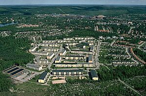
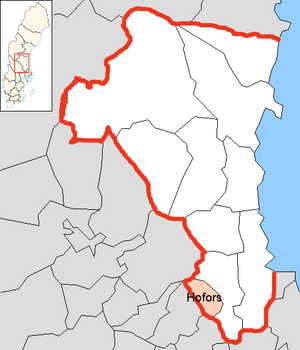
Hofors Municipality (Hofors kommun) is a local area in Sweden. It is located in the east-central part of the country, in Gävleborg County. The main town, or "seat," of the municipality is Hofors. About 7,400 people live in Hofors. The municipality is known for its history related to iron mining.
History of Hofors
The area that is now Hofors Municipality has an interesting past. The first municipality named Hofors was created in 1925. It was formed by separating from another area called Torsåker. Later, in 1971, these two areas joined back together. This created the Hofors Municipality we know today.
The municipality's coat of arms was designed in 1968. It is based on an old map from 1539. This map showed the town of Hofors surrounded by many iron mines. This design highlights the area's long history with mining.
Geography
Hofors Municipality is located in a central part of Sweden. The closest large cities are Gävle, which is about 50 kilometers (31 miles) away, and Falun, which is about 30 kilometers (19 miles) away.
Main Towns
The municipality includes a few important towns and villages.
- Hofors (This is the main town and administrative center)
- Torsåker
Demographics
Hofors Municipality is home to many Swedish citizens who are old enough to vote. In 2022, there were 7,375 such citizens living in the municipality. When they voted in the general election, about 50.8% supported the left-leaning political parties. Around 48.1% voted for the right-leaning parties.
Sister Cities
Hofors Municipality has special connections with other towns in different countries. These are called "sister cities" or "twin towns." They often share cultural exchanges and friendly relationships. Hofors has two sister cities:
- Denmark: Fladså
- Finland: Kontiolahti
In the past, Tokke in Norway was also a sister city. However, this partnership has since ended.
See also
 In Spanish: Municipio de Hofors para niños


