Hogback Mountain (Loudoun County, Virginia) facts for kids
Quick facts for kids Hogback Mountain |
|
|---|---|
| Highest point | |
| Elevation | 670 ft (200 m) |
| Prominence | 130 ft (40 m) |
| Parent peak | Catoctin Mountain |
| Geography | |
| Location | Loudoun County, Virginia, U.S. |
| Parent range | Blue Ridge Mountains Appalachian Mountains |
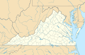
Hogback Mountain is a cool part of the Catoctin Mountain range. It's located in Loudoun County, Virginia, in the U.S.. This mountain ridge is special because of its unique shape, which actually gave it its name!
Contents
Discover Hogback Mountain
Hogback Mountain is a long, narrow mountain ridge. It's part of the larger Catoctin Mountain system. This mountain is found southwest of a town called Leesburg. It stands tall right next to U.S. Route 15, which is a major road.
Where is Hogback Mountain?
The mountain ridge starts just south of a stream called Sycolin Creek. From there, it stretches out for about 2.5 miles (4 kilometers) to the south. Its southern end reaches the banks of another stream, Goose Creek. So, it's nestled between two creeks!
How Did It Get Its Name?
Hogback Mountain gets its interesting name from its shape. If you look at it from the north, it really does look like a pig lying on its back! Imagine a pig's back curving up, and that's how this mountain looks. This kind of landform is often called a "hogback" in geology.
A Little About Maps
Sometimes, even official maps can have small mistakes. Older maps from the USGS (United States Geological Survey) used to show Hogback Mountain in the wrong place. They mistakenly put it further north, between Sycolin Creek and Leesburg. But now, maps show its correct location.
 | Delilah Pierce |
 | Gordon Parks |
 | Augusta Savage |
 | Charles Ethan Porter |


