Holcomb Rock Dam facts for kids
Quick facts for kids Holcomb Rock Dam |
|
|---|---|
|
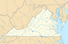
Location of Holcomb Rock Dam in Virginia
|
|
| Location | Bedford County, Virginia / Amherst County, Virginia, U.S. |
| Coordinates | 37°30′36.15″N 79°15′57.11″W / 37.5100417°N 79.2658639°W |
| Purpose | Power |
| Status | In use |
| Opening date | 1850 |
| Owner(s) | Holcomb Rock Company |
| Operator(s) | Holcomb Rock Company |
| Dam and spillways | |
| Type of dam | Concrete gravity |
| Impounds | James River |
| Height | 39 ft (12 m) |
| Length | 644 ft (196 m) |
| Spillway type | weir |
| Power station | |
| Operator(s) | Holcomb Rock Company |
| Hydraulic head | 18 |
The Holcomb Rock Dam is an old and important dam built across the James River in Virginia. It's located near the city of Lynchburg, Virginia. This dam helps to make electricity for homes and businesses.
The dam is made of strong concrete. It works by holding back the river's water. This creates a difference in water levels, which is used to generate power.
The Holcomb Rock Dam project includes a concrete wall across the river. It also has an earthen canal built on the side of the river. There is a special building called a power house. This is where the water flows through to create electricity.
Contents
What is the Holcomb Rock Dam?
The Holcomb Rock Dam is a type of dam called a concrete gravity dam. This means it uses its own heavy weight to hold back the water. It's a very strong structure that has been working for a long time.
The dam is 644 feet (about 196 meters) long. It stands about 39 feet (nearly 12 meters) tall. That's like a four-story building!
How Does the Dam Make Electricity?
The main job of the Holcomb Rock Dam is to make electricity. This process is called hydroelectric power. Here's how it generally works:
- Water from the river is held back by the dam.
- Some of this water is sent through a special canal.
- The water then rushes into the power house.
- Inside the power house, the moving water spins large machines called turbines.
- These turbines are connected to generators, which then create electricity.
In 2008, the dam generated over 6 million kilowatt-hours of electricity. That's enough power for many homes!
Where is the Holcomb Rock Dam Located?
The Holcomb Rock Dam is found in Virginia, in both Bedford County, Virginia and Amherst County, Virginia. It's built on the James River.
It is located downstream from another, even bigger dam. That dam is called the Coleman Falls Dam.
History of the Holcomb Rock Dam
The Holcomb Rock Dam is quite old. It was first opened way back in 1850. That means it has been operating for over 170 years! It shows how well dams can be built to last.
The dam is owned and operated by the Holcomb Rock Company. They make sure it keeps working safely and efficiently.
 | Percy Lavon Julian |
 | Katherine Johnson |
 | George Washington Carver |
 | Annie Easley |


