Hoquiam River facts for kids
Quick facts for kids Hoquiam River |
|
|---|---|

Hoquiam River
|
|
|
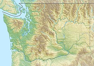
Location of the mouth of the Hoquiam River in Washington
|
|
| Country | United States |
| State | Washington |
| County | Grays Harbor |
| Physical characteristics | |
| Main source | Confluence of West Fork and East Fork Willapa Hills 47°1′55″N 123°55′7″W / 47.03194°N 123.91861°W |
| River mouth | Grays Harbor 0 ft (0 m) 46°58′12″N 123°52′41″W / 46.97000°N 123.87806°W |
| Length | 6 mi (9.7 km) |
| Basin features | |
| Basin size | 98 sq mi (250 km2) |
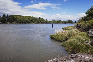
The Hoquiam River is a cool stream in Washington State, USA. It has three main branches or "forks": the East Fork, West Fork, and Middle Fork. The main part of the Hoquiam River starts when the West Fork and East Fork join together. The Middle Fork flows into the West Fork.
Most of the land that drains into the Hoquiam River is part of the Weyerhaeuser Twin Harbors Tree Farm. The nearby city of Hoquiam owns about 7,500 acres (30 km²) of this area. This land includes special reservoirs on Davis Creek and the West Fork Hoquiam River. These reservoirs are super important because they provide all the drinking water for the city of Hoquiam.
The Hoquiam River area is one of the best places in the world for growing trees. It's a very important spot for the timber industry. Most of the old, original forests and even the second-growth forests have been cut down. Now, you'll mostly see new plantations of Douglas-fir trees growing there.
The river's name comes from a Native American word. It means "hungry for wood." This name was given because so much driftwood used to pile up at the river's mouth.
Contents
Where the Hoquiam River Flows
The Hoquiam River begins its journey in Grays Harbor County, Washington. It generally flows south. Eventually, it reaches the city of Hoquiam. There, it empties into Grays Harbor. Grays Harbor is a special kind of bay where the river meets the Pacific Ocean.
The river has several important branches. These include the North, East, and Middle Forks. There's also the Little Hoquiam River and its own North Fork. All these different branches come together close to the coast. This means the main part of the Hoquiam River is actually quite short compared to its many tributaries.
The Main Forks
The East, West, and Middle Forks all start north of Grays Harbor. They flow mostly south. The East Fork Hoquiam River is the longest branch. It stretches for about 22 miles (35 km). It joins the West Fork to form the main Hoquiam River. This happens near the cities of Hoquiam and Aberdeen.
Both the West Fork and Middle Fork are about 9 miles (14 km) long. A major road, U.S. Route 101, runs alongside the West Fork. The West Fork also joins the East Fork to create the main river. The Middle Fork is a smaller branch that flows into the West Fork.
The main Hoquiam River is formed when the East and West Forks meet. From that point, it flows south for about 6 miles (10 km). Then, it empties right into Grays Harbor.
Other River Branches
Another branch is the Little Hoquiam River. It starts west of Hoquiam. It flows east for about 6 miles (10 km). It then joins the West Fork Hoquiam River. This meeting point is just a bit upstream from where the West and East Forks combine.
The Little Hoquiam River has its own main branch. This is called the North Fork Little Hoquiam River. It's almost as long as the Little Hoquiam River itself.
Amazing Animals of the Hoquiam River
The Hoquiam River and its many branches are home to lots of cool fish. These include different types of Chinook, chum, and coho salmon. You can also find steelhead and sea-run coastal cutthroat trout here.
In recent years, some barriers in the river have been removed or fixed. These barriers were things like culverts (tunnels for water) that blocked fish. Now, fish can swim upstream much farther and more easily. This helps them find good places to lay their eggs and grow.
 | Bessie Coleman |
 | Spann Watson |
 | Jill E. Brown |
 | Sherman W. White |


