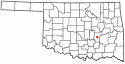
Horntown, Oklahoma facts for kids
Quick facts for kids
Horntown, Oklahoma
|
|
|---|---|

Location of Horntown, Oklahoma
|
|
| Country | United States |
| State | Oklahoma |
| County | Hughes |
| Area | |
| • Total | 4.01 sq mi (10.38 km2) |
| • Land | 3.95 sq mi (10.24 km2) |
| • Water | 0.05 sq mi (0.14 km2) |
| Elevation | 843 ft (257 m) |
| Population
(2020)
|
|
| • Total | 92 |
| • Density | 23.27/sq mi (8.98/km2) |
| Time zone | UTC-6 (Central (CST)) |
| • Summer (DST) | UTC-5 (CDT) |
| FIPS code | 40-36090 |
| GNIS feature ID | 2412768 |
Horntown is a small town in Hughes County, Oklahoma, United States. In 2010, the town had a population of 97 people. This was an increase from the 61 people counted in 2000. By 2020, the population was 92.
History of Horntown
Horntown started as a small rural community in Hughes County during the 1920s. It was located in an area called Jacobs Township.
The first people to settle here were T. C. Horn and Charley Hawthorn. They opened stores, garages, gas stations, and a restaurant. These businesses were at a busy crossroads where two main roads met. Today, these roads are known as U.S. Highways 75 and 270.
Horntown officially became a town on August 2, 1995. At that time, it covered about 4 square miles. Around 200 people lived in the immediate area served by Horntown's businesses.
By the year 2000, the official census counted 61 residents living inside the town limits. The population grew to 97 by the 2010 census. At that time, Horntown had a convenience store, a restaurant, a gas station, and a tire store. The town also had its own fire department, law enforcement, and emergency services. The Banner Baptist Church served the local residents.
Geography of Horntown
Horntown is located in the middle of Hughes County, Oklahoma. It is a lightly populated town. The town's center is where U.S. Routes 75 and 270 cross paths.
- US 75 goes north for about 10 miles (16 km) to Wetumka.
- US 270 goes west for about 8 miles (13 km) to Holdenville, which is the main town for Hughes County.
Both US 75 and US 270 join together in Horntown. From there, they go south for about 8 miles (13 km) to Calvin.
The town covers a total area of about 4.0 square miles (10.4 square kilometers). Most of this area is land. Only a small part, about 0.1 square miles (0.26 square kilometers), is water. The town's water flows north through Grief Creek and Graves Creek. These creeks then join Wewoka Creek, which is a branch of the North Canadian River.
Population Information
| Historical population | |||
|---|---|---|---|
| Census | Pop. | %± | |
| 2000 | 61 | — | |
| 2010 | 97 | 59.0% | |
| 2020 | 92 | −5.2% | |
| U.S. Decennial Census | |||
In 2000, there were 61 people living in Horntown. These people lived in 27 households, and 21 of these were families. The population density was about 15 people per square mile. There were 30 homes in the town.
The people living in Horntown were mostly White (88.52%) and Native American (11.48%).
The average age of people in the town was 44 years old. For every 100 females, there were about 90 males.
Education
Students in Horntown attend schools in the Moss Public Schools school district.
See also
 In Spanish: Horntown (Oklahoma) para niños
 | Madam C. J. Walker |
 | Janet Emerson Bashen |
 | Annie Turnbo Malone |
 | Maggie L. Walker |

