Horseshoe Lake, Arizona facts for kids
Quick facts for kids Horseshoe Lake |
|
|---|---|

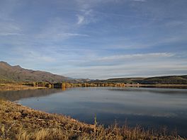
The top of Horseshoe Reservoir looking north in December 2015
|
|
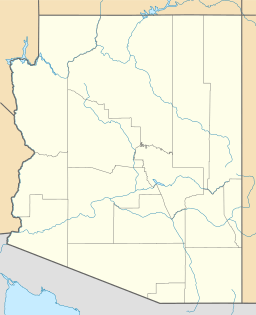
| Location | Maricopa / Yavapai counties, Arizona, United States |
| Coordinates | 33°59′8.83″N 111°43′16.21″W / 33.9857861°N 111.7211694°W |
| Type | Reservoir |
| Primary inflows | Verde River |
| Primary outflows | Verde River |
| Basin countries | United States |
| Max. length | 5 mi (8.0 km) |
| Surface area | 790 acres (320 ha) |
| Average depth | 30 ft (9.1 m) |
| Max. depth | 77 ft (23 m) |
| Water volume | 109,217 acre⋅ft (134,717,000 m3) |
| Shore length1 | 27 mi (43 km) |
| Surface elevation | 2,200 ft (670 m) |
| 1 Shore length is not a well-defined measure. | |
Horseshoe Lake is a large reservoir in the state of Arizona, United States. It was created by building the Horseshoe Dam across the Verde River. This lake and its dam are found within the beautiful Tonto National Forest. Horseshoe Lake is located north of another lake called Bartlett Lake. The important job of managing the dam and the lake is handled by the Salt River Project.
Contents
What is Horseshoe Lake?
Horseshoe Lake is not a natural lake. It is a type of artificial lake called a reservoir. Reservoirs are made by building a large wall, or dam, across a river. This dam holds back the river's water, forming a lake behind it.
Why are Reservoirs Built?
Reservoirs like Horseshoe Lake are very important. They help store water for many uses. This water can be used for drinking, farming, and even generating electricity. Reservoirs also help control floods by holding back excess water during heavy rains.
Location and Surroundings
Horseshoe Lake is located in central Arizona. It sits partly in Maricopa County and partly in Yavapai County. The lake is completely surrounded by the vast Tonto National Forest. This forest is a protected area with many plants and animals.
The Verde River
The Verde River is a major river in Arizona. It flows into Horseshoe Lake and then continues flowing out of it. The Verde River is a vital source of water for many communities. It also supports a rich variety of wildlife.
Who Manages Horseshoe Lake?
The Salt River Project (SRP) is in charge of Horseshoe Dam and Lake. SRP is a large utility company in Arizona. They manage a complex system of dams, reservoirs, and canals. Their main goal is to provide water and electricity to people in central Arizona.
The Role of Salt River Project
SRP's work at Horseshoe Lake includes making sure the dam is safe. They also control how much water is released from the lake. This helps manage water levels for different needs. It also helps prevent floods downstream.
Facts About Horseshoe Lake
Horseshoe Lake is quite large. It stretches for about 5 miles (8 kilometers). The shoreline, which is the edge of the lake, is about 27 miles (43 kilometers) long. At its deepest point, the lake is about 77 feet (23 meters) deep.
Water Storage
The lake can hold a lot of water. Its total volume is about 109,217 acre-feet. An acre-foot is the amount of water needed to cover one acre of land with water one foot deep. This shows how much water Horseshoe Lake can store for Arizona.


