
Houlgate facts for kids
Quick facts for kids
Houlgate
|
|
|---|---|

Town logo
|
|

Houlgate
Location in France

Houlgate
Location in Normandy
|
|
| Country | France |
| Region | Normandy |
| Department | Calvados |
| Arrondissement | Lisieux |
| Canton | Dozulé |
| Intercommunality | Estuaire de la Dives |
| Area
1
|
4.69 km2 (1.81 sq mi) |
| Population
(2006)
|
1,902 |
| • Density | 405.5/km2 (1,050.4/sq mi) |
| Time zone | UTC+01:00 (CET) |
| • Summer (DST) | UTC+02:00 (CEST) |
| INSEE/Postal code |
14338 /14510
|
| 1 French Land Register data, which excludes lakes, ponds, glaciers > 1 km2 (0.386 sq mi or 247 acres) and river estuaries. | |
Houlgate is a lovely little town in northwestern France. It's a popular place for tourists, right by the English Channel. People come here to enjoy the beach and visit the casino.
Houlgate is a type of town called a commune. It's located in the Calvados department within the Basse-Normandie region.
History of Houlgate
Houlgate started as a tiny village, or hamlet. It was part of an older area called Beuzeval. This land was once owned by powerful families, known as lords.
Over time, different families took control of the land through marriage. Eventually, much of the land in Beuzeval was sold to farmers. Houlgate slowly grew and became more important than Beuzeval.
In the mid-1800s, between 1845 and 1850, people discovered how fun it was to swim in the sea here. This made Houlgate a popular spot for summer visitors.
Geography of Houlgate
Houlgate is located right next to the English Channel. It sits in a valley formed by a small river called the Drochon.
Most of the valley is now covered by buildings. Some parts are still used for grazing animals. The town covers an area of about 4.69 square kilometers.
Even though the town's average height is low, it has two hills. These hills mark the natural edges of the commune.
Images for kids
-
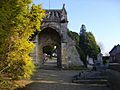
The old church of Saint Aubin in Beuzeval.
-
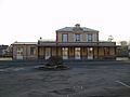
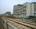
Houlgate train station in winter 2008
-
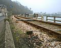
Houlgate sea retainer wall in spring 2005
-
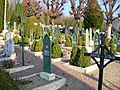
First World War graves in Beuzeval cemetery
-
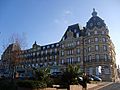
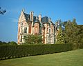
Houlgate Grand Hotel
-
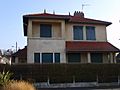
Houlgate Kommandantur, Villa Onexis.
-
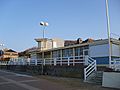
The new Etablissement des Bains.
-
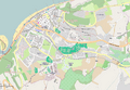
A plan of the town
-
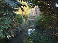
The Drochon as seen from the Rue Pasteur.
-
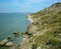
Falaises des Vaches Noires, summer 2004
-
The Manor of Beuzeval in summer 2004
-
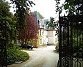
the Château de Dramard in 2004
-
Hôtel Imbert in spring 2005
-
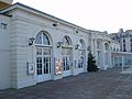
Casino's cinema.


See also
 In Spanish: Houlgate para niños
