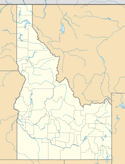
Howe, Idaho facts for kids
Quick facts for kids
Howe, Idaho
|
|
|---|---|
| Country | United States |
| State | Idaho |
| County | Butte |
| Elevation | 4,829 ft (1,472 m) |
| Time zone | UTC-7 (Mountain (MST)) |
| • Summer (DST) | UTC-6 (MDT) |
| ZIP code |
83244
|
| Area code(s) | 208, 986 |
| GNIS feature ID | 383478 |
Howe is a small, unincorporated community located in Butte County, Idaho, in the United States. An unincorporated community is a place that doesn't have its own local government, like a city or town. It's found along Idaho State Highway 33, about 18 miles (29 km) northeast of a town called Arco. Howe even has its own post office with the ZIP code 83244.
Howe's History
Howe has been a small community for a long time. In 1909, it was estimated that about 50 people lived there. By 1960, the number of residents had become smaller, with only about 25 people calling Howe home. This shows that Howe has always been a very small, quiet place.
Howe's Climate
Howe experiences a type of weather known as a cold semi-arid climate. On climate maps, this is often shown as "BSk". A semi-arid climate means the area is quite dry, similar to a desert, but it gets enough rain to support some plant life. The "cold" part means that winters can be very chilly.
The hottest temperature ever recorded in Howe was a scorching 103 degrees Fahrenheit (39 degrees Celsius). This happened on July 15, 2002, and again on July 23–24, 2003. On the other hand, the coldest temperature ever recorded was a freezing -38 degrees Fahrenheit (-39 degrees Celsius) on February 1, 1985. That's colder than most home freezers!
| Climate data for Howe, Idaho, 1991–2020 normals, extremes 1914–present | |||||||||||||
|---|---|---|---|---|---|---|---|---|---|---|---|---|---|
| Month | Jan | Feb | Mar | Apr | May | Jun | Jul | Aug | Sep | Oct | Nov | Dec | Year |
| Record high °F (°C) | 58 (14) |
75 (24) |
74 (23) |
86 (30) |
96 (36) |
102 (39) |
103 (39) |
102 (39) |
100 (38) |
85 (29) |
69 (21) |
58 (14) |
103 (39) |
| Mean maximum °F (°C) | 44.5 (6.9) |
48.8 (9.3) |
63.7 (17.6) |
75.5 (24.2) |
82.6 (28.1) |
91.0 (32.8) |
96.9 (36.1) |
95.9 (35.5) |
89.6 (32.0) |
77.4 (25.2) |
59.5 (15.3) |
47.4 (8.6) |
97.9 (36.6) |
| Mean daily maximum °F (°C) | 29.9 (−1.2) |
34.6 (1.4) |
47.7 (8.7) |
58.7 (14.8) |
67.4 (19.7) |
76.3 (24.6) |
87.4 (30.8) |
85.9 (29.9) |
75.5 (24.2) |
60.0 (15.6) |
42.8 (6.0) |
30.3 (−0.9) |
58.0 (14.5) |
| Daily mean °F (°C) | 18.6 (−7.4) |
23.3 (−4.8) |
36.0 (2.2) |
45.1 (7.3) |
53.5 (11.9) |
61.0 (16.1) |
69.2 (20.7) |
67.3 (19.6) |
57.4 (14.1) |
45.1 (7.3) |
30.9 (−0.6) |
20.6 (−6.3) |
44.0 (6.7) |
| Mean daily minimum °F (°C) | 7.3 (−13.7) |
12.0 (−11.1) |
24.4 (−4.2) |
31.6 (−0.2) |
39.7 (4.3) |
45.7 (7.6) |
51.1 (10.6) |
48.7 (9.3) |
39.4 (4.1) |
30.1 (−1.1) |
18.9 (−7.3) |
10.9 (−11.7) |
30.0 (−1.1) |
| Mean minimum °F (°C) | −14.1 (−25.6) |
−8.8 (−22.7) |
7.6 (−13.6) |
17.1 (−8.3) |
25.8 (−3.4) |
33.4 (0.8) |
40.6 (4.8) |
36.8 (2.7) |
26.7 (−2.9) |
14.4 (−9.8) |
0.6 (−17.4) |
−12.5 (−24.7) |
−19.0 (−28.3) |
| Record low °F (°C) | −35 (−37) |
−38 (−39) |
−23 (−31) |
1 (−17) |
16 (−9) |
25 (−4) |
29 (−2) |
28 (−2) |
18 (−8) |
−5 (−21) |
−22 (−30) |
−37 (−38) |
−38 (−39) |
| Average precipitation inches (mm) | 0.59 (15) |
0.34 (8.6) |
0.55 (14) |
0.77 (20) |
1.22 (31) |
1.04 (26) |
0.44 (11) |
0.43 (11) |
0.52 (13) |
0.62 (16) |
0.36 (9.1) |
0.38 (9.7) |
7.26 (184.4) |
| Average snowfall inches (cm) | 4.7 (12) |
0.9 (2.3) |
0.4 (1.0) |
0.3 (0.76) |
0.0 (0.0) |
0.0 (0.0) |
0.0 (0.0) |
0.0 (0.0) |
0.0 (0.0) |
0.1 (0.25) |
0.5 (1.3) |
4.2 (11) |
11.1 (28.61) |
| Average precipitation days (≥ 0.01 in) | 2.5 | 2.5 | 2.2 | 3.7 | 5.3 | 4.0 | 2.1 | 2.3 | 2.6 | 2.8 | 1.9 | 3.0 | 34.9 |
| Average snowy days (≥ 0.1 in) | 1.1 | 0.5 | 0.2 | 0.1 | 0.0 | 0.0 | 0.0 | 0.0 | 0.0 | 0.1 | 0.2 | 1.6 | 3.8 |
| Source 1: NOAA | |||||||||||||
| Source 2: National Weather Service | |||||||||||||
 | Jackie Robinson |
 | Jack Johnson |
 | Althea Gibson |
 | Arthur Ashe |
 | Muhammad Ali |


