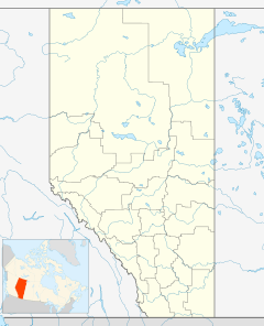
Hughenden, Alberta facts for kids
Quick facts for kids
Hughenden
|
|
|---|---|
|
Village
|
|
| Village of Hughenden | |
| Country | Canada |
| Province | Alberta |
| Region | Central Alberta |
| Census Division | No. 7 |
| Municipal district | Municipal District of Provost No. 52 |
| Incorporated | |
| • Village | December 27, 1917 |
| Area
(2021)
|
|
| • Land | 0.78 km2 (0.30 sq mi) |
| Elevation | 690 m (2,260 ft) |
| Population
(2021)
|
|
| • Total | 213 |
| • Density | 272.5/km2 (706/sq mi) |
| Time zone | UTC−7 (MST) |
| • Summer (DST) | UTC−6 (MDT) |
| Highways | 13 |
Hughenden /hjuːˈɛndən/ is a small village in central Alberta, Canada. It is located about 49 kilometers (30 miles) south of Wainwright. You can find Hughenden along Highway 13.
About Hughenden
Hughenden got its name from a famous place in England called Hughenden Manor. This was the home of Benjamin Disraeli, who was a very important leader (Prime Minister) in England a long time ago. The village became an official village on December 27, 1917.
How Many People Live Here?
Every few years, Canada counts how many people live in different places. This is called a census.
- In 2021, the Village of Hughenden had 213 people living there. They lived in 97 homes.
- In 2016, there were 243 people living in Hughenden.
- In 2012, a local count showed about 258 people.
So, the number of people living in Hughenden has changed a bit over the years.
Black History Month on Kiddle
Famous African-American Inventors:
 | George Robert Carruthers |
 | Patricia Bath |
 | Jan Ernst Matzeliger |
 | Alexander Miles |

All content from Kiddle encyclopedia articles (including the article images and facts) can be freely used under Attribution-ShareAlike license, unless stated otherwise. Cite this article:
Hughenden, Alberta Facts for Kids. Kiddle Encyclopedia.

