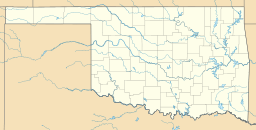
Hulah Lake (Oklahoma) facts for kids
Quick facts for kids Hulah Lake |
|
|---|---|
| Location | Osage County, Oklahoma |
| Coordinates | 36°56′06″N 96°05′30″W / 36.93500°N 96.09167°W |
| Type | reservoir |
| Primary inflows | Caney River |
| Surface area | 3,570 acres (1,440 ha) |
| Water volume | 289,000 acre-feet (356,000,000 m3) |
| Surface elevation | 733 feet (223 m) |
Hulah Lake is a large, man-made lake in northeastern Osage County, Oklahoma. It was created by the United States Army Corps of Engineers when they built a dam across the Caney River. The lake is located within the Osage Indian Reservation.
The name Hulah comes from an Osage word that means "eagle." It was also the name of a farming community that was in the valley before the dam was built. The main reason for creating Hulah Lake was to control floods. However, it has also become a very popular place for people to visit and have fun. The entire Hulah Lake project, including a public hunting area, covers a total of 21,510 acres (8,700 ha).
Building the Hulah Dam
The dam that created Hulah Lake is a special type called a gravity dam. It has a core made of earth and sits on a strong rock foundation. The dam is 94 feet (29 m) tall, which is about as high as a nine-story building. It is also very long, stretching 5,200 feet (1,600 m) across the valley.
Construction of the dam was finished in 1961. It was designed to handle a lot of water, with a maximum discharge capacity of 266,000 cubic feet (7,500 m3) per second. This helps to prevent flooding downstream.
Hulah Lake's Size and Purpose
Hulah Lake collects water from a large area of 732 square miles (1,900 km2). The lake can hold a huge amount of water, about 289,000 acre-feet (356,000,000 m3). When the water level is normal, the lake's surface covers 3,570 acres (1,440 ha). This is like having more than 2,700 football fields filled with water!
The shoreline of the lake stretches for about 62 miles (100 km), which is a long distance for boating, fishing, or just exploring. The normal water level, called the conservation pool, is 733 feet (223 m) above sea level. During floods, the lake can rise to 765 feet (233 m) to hold extra water and protect the areas below the dam.


