Caney River facts for kids
Quick facts for kids Caney River |
|
|---|---|
 |
|
| Native name | Kènii Sipu |
| Other name(s) | Little Verdigris, Cana, Connie |
| Country | United States |
| State | Kansas, Oklahoma |
| City | Bartlesville, OK |
| Physical characteristics | |
| Main source | Elk County, Kansas, United States 548 ft (167 m) 37°29′14″N 096°28′34″W / 37.48722°N 96.47611°W |
| River mouth | Verdigris River Near Verdigris, Oklahoma, United States 167 ft (51 m) 36°20′16″N 095°41′57″W / 36.33778°N 95.69917°W |
| Length | 180 mi (290 km), South |
| Basin features | |
| River system | Verdigris River |
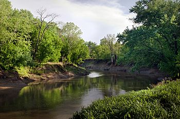
The Caney River is a long river in the United States. It flows through southern Kansas and northeastern Oklahoma. The river is about 180-mile-long (290 km). In the Lenape language, its name is Kènii Sipu. The Caney River usually has calm, flat water. It flows into the Verdigris River.
Contents
Where Does the Caney River Flow?
The Caney River starts in Elk County, Kansas, near the town of Grenola. From there, it flows south into Oklahoma. It enters Oklahoma near Elgin, Kansas.
Journey Through Oklahoma
As the river continues south, it goes through Osage County. Here, a dam was built to create Hulah Lake. After the dam, the river flows into Washington County. It goes right through the middle of Bartlesville. In Bartlesville, the river separates the downtown area from the homes on the east side.
South of Bartlesville, the Caney River turns southeast. It then flows into Rogers County. Finally, it joins the Verdigris River. This meeting point is between the towns of Collinsville and Claremore.
Fun on the River
The Caney River is usually calm, which makes it great for activities. People especially enjoy canoeing on its waters. You can canoe both above and below Hulah Lake.
However, there are not many places for boaters to stop. This is true for the long stretch between Wah-Sha-She Park (which is near Hulah Dam) and where the river meets the Verdigris River.
The River and Floods
While usually calm, the Caney River can cause big floods. This happens when there are very heavy rainstorms in the area.
Major Floods in Bartlesville
Bartlesville has experienced serious floods from the Caney River. Big floods happened in:
- 1885
- 1926
- 1986
The 1986 Flood
The dam at Hulah Lake is managed by the United States Army Corps of Engineers. In October 1986, there was a lot of rain in the Great Plains. Because of this, the Corps had to open the floodgates at the dam.
This caused a very large flood in Bartlesville. The flood split the city almost in half for several days. It caused a lot of damage, costing more than US$30 million.
 | Dorothy Vaughan |
 | Charles Henry Turner |
 | Hildrus Poindexter |
 | Henry Cecil McBay |

