Hull Shore Drive and Nantasket Avenue facts for kids
Quick facts for kids |
|
|
Hull Shore Drive, Nantasket Avenue, Metropolitan Park System of Greater Boston MPS
|
|

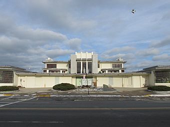
Mary Jeanette Murray Bath House
|
|
| Location | Hull, Massachusetts |
|---|---|
| Area | 6.5 acres (2.6 ha) |
| MPS | Metropolitan Park System of Greater Boston MPS |
| NRHP reference No. | 03001470 |
| Added to NRHP | January 21, 2004 |
Hull Shore Drive and Nantasket Avenue are two important roads in Hull, Massachusetts. They form a historic coastal road system. Nantasket Avenue is the main road that goes through the town of Hull. It is also known as Route 228. Hull Shore Drive is a shorter part of this road. It is located near the famous Nantasket Beach Reservation.
A special part of these roads, about 1.25 miles (2 km) long, was added to the National Register of Historic Places in 2004. This means it's a very important historical site!
Contents
Exploring the Roads of Hull
Nantasket Avenue starts in the towns of Hingham and Cohasset. It meets other roads like Rockland Street and Jerusalem Road there. Nantasket Avenue and Hull Street together make up Massachusetts Route 228. This road forms the border between Hingham and Cohasset for a bit.
Journey Through Hull
The road then crosses over the Straits Pond Dam. After this, it enters the town of Hull. It travels north through the hilly southern part of Hull. Soon, it reaches the long, narrow part of the Hull peninsula. On its eastern side, you can see the beautiful Nantasket Beach.
Where Hull Shore Drive Begins
Nantasket Avenue continues until it meets Hull Shore Drive. This is where Route 228 officially ends. At this point, George Washington Boulevard goes southwest. Hull Shore Drive and Nantasket Avenue then become a divided road. Hull Shore Drive is for cars going north. Nantasket Avenue is for cars going south. Hull Shore Drive is on the eastern side.
The Northern Stretch
Hull Shore Drive ends near Water Street. This is close to the northern end of Nantasket Beach Reservation. After this, the northbound lanes are also called Nantasket Avenue. The divided road ends at Phipps Street. Nantasket Avenue then keeps going north. It follows the main ridge of the Hull Peninsula.
Reaching the End of the Peninsula
The road then goes around the southwestern part of the Point Allerton neighborhood. After that, it turns west. It follows the curve of the peninsula near the Hull Yacht Club. The peninsula becomes very narrow here. Finally, it goes around the north side of Telegraph Hill. Fort Revere is located on Telegraph Hill. The road ends at a three-way intersection with Main Street.
 | Bessie Coleman |
 | Spann Watson |
 | Jill E. Brown |
 | Sherman W. White |


