Hultsfred Municipality facts for kids
Quick facts for kids
Hultsfred Municipality
Hultsfreds kommun
|
||
|---|---|---|

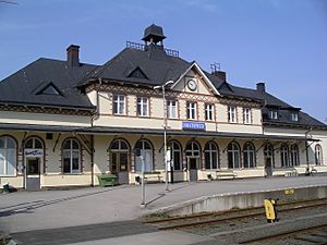
Hultsfred Railway Station
|
||
|
||
 |
||
| Country | Sweden | |
| County | Kalmar County | |
| Seat | Hultsfred | |
| Area | ||
| • Total | 1,193.028 km2 (460.631 sq mi) | |
| • Land | 1,127.138 km2 (435.190 sq mi) | |
| • Water | 65.89 km2 (25.44 sq mi) | |
| Area as of January 1, 2010. | ||
| Population
(June 30, 2012)
|
||
| • Total | 13,785 | |
| • Density | 11.5546/km2 (29.9264/sq mi) | |
| Time zone | UTC+1 (CET) | |
| • Summer (DST) | UTC+2 (CEST) | |
| ISO 3166 code | SE | |
| Province | Småland | |
| Municipal code | 0860 | |
| Website | www.hultsfred.se | |
| Density is calculated using land area only. | ||
Hultsfred Municipality (which in Swedish is Hultsfreds kommun) is a local area in Kalmar County, located in south-eastern Sweden. The main town and administrative center of the municipality is Hultsfred.
This municipality was formed in 1971. It was created by joining the market town of Hultsfred (which became a town in 1927) with several smaller areas around it. Before this, in 1863, there were eight separate local areas in this region.
Hultsfred is also famous for hosting a big rock music event called the Hultsfred Festival.
Contents
History of Hultsfred
During the Nordic Bronze Age, which was a very long time ago, people in this area traded animal furs with northern Germany and the Roman army. We don't know much else from that time, but we know people lived here. Even older items from 3000 to 4000 BC have been found.
Around 1100 AD, during the medieval age, some churches were built here and still stand today. For a long time, until the 1900s, most people in the area were farmers.
Industry and Growth
In the 1600s and 1700s, there was some iron mining in Kalmar County. Two of the ten mines were located in what is now Hultsfred Municipality.
In the 1800s, Hultsfred was a place where military companies practiced. You can still visit some of the old buildings from that time near Silverån. When railroads were built across Sweden in the late 1800s, Hultsfred grew a lot because it became easier to travel and transport goods.
Today, there are several local museums in the area. They help keep the history of Hultsfred alive for everyone to learn about.
Geography of Hultsfred
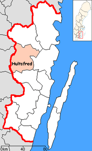
Most of the towns and villages in Hultsfred Municipality are located along the railway lines. Besides Hultsfred, which is in the middle-north of the municipality, you'll find towns like Virserum in the south-west. There are also smaller places such as Lönneberga, Silverdalen, and Målilla.
Over the last 10 years, the number of people living in the municipality has gone down by about 2,000. This is because many people are moving to bigger cities.
Nature and Landscape
A large part of Hultsfred Municipality is covered by forests. This is very common for the whole province of Småland. There are only a few scattered areas that are good for farming.
Towns and Villages
There are eight main urban areas (also called Tätort or locality) in Hultsfred Municipality.
The table below lists these places by how many people lived there on December 31, 2005. The main town, which is the municipal seat, is shown in bold.
| # | Locality | Population |
|---|---|---|
| 1 | Hultsfred | 5,305 |
| 2 | Virserum | 1,847 |
| 3 | Målilla | 1,605 |
| 4 | Mörlunda | 956 |
| 5 | Silverdalen | 791 |
| 6 | Järnforsen | 539 |
| 7 | Vena | 380 |
| 8 | Rosenfors | 308 |
International Connections
Hultsfred Municipality has a special connection with another town in a different country. This is called a "twin town" or "sister city" relationship.
Twin Towns
Hultsfred Municipality is twinned with:
See also
 In Spanish: Municipio de Hultsfred para niños
 | James B. Knighten |
 | Azellia White |
 | Willa Brown |


