Huney facts for kids
| OS grid reference | HP648063 |
|---|---|
| Coordinates | 60°44′06″N 0°48′40″W / 60.735095°N 0.811143°W |
| Physical geography | |
| Island group | Shetland |
| Area | 17 hectares (42 acres) |
| Highest elevation | 19 m |
| Administration | |
| Sovereign state | United Kingdom |
| Country | Scotland |
| Council area | Shetland Islands |
| Demographics | |
| Population | 0 |
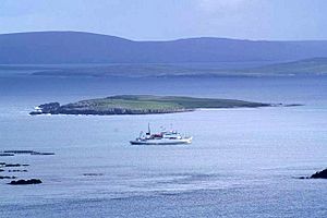
Huney is a small, uninhabited island located in the Shetland Islands of Scotland. It lies just east of the island of Unst. Huney is quite tiny, covering an area of less than 0.2 square kilometers (about 0.08 square miles).
At very low tides, Huney connects to Unst by a sandy strip of land. This natural bridge is called a tombolo, and this specific one is known as the Yei of Huney. Because of its small size and connection to Unst, Huney remains an island where no one lives.
A World War I Submarine Story
The Sinking of HMS E49
During World War I, a British submarine named HMS E49 was lost near Huney. On March 12, 1917, the submarine was leaving Balta Sound, a nearby inlet, to go on patrol. Sadly, it hit a naval mine.
A War Grave Site
The mine was likely placed by a German U-boat, which is a type of submarine. The sinking of HMS E49 resulted in the loss of 3 officers and 28 crew members. Today, the wreck of HMS E49 rests on the seabed between Huney and the island of Balta. It is now officially recognized as a war grave, a protected site honoring those who died.
See also
 In Spanish: Huney para niños
 | Stephanie Wilson |
 | Charles Bolden |
 | Ronald McNair |
 | Frederick D. Gregory |


