Huntingfield, Tasmania facts for kids
Quick facts for kids HuntingfieldHobart, Tasmania |
|||||||||||||||
|---|---|---|---|---|---|---|---|---|---|---|---|---|---|---|---|
| Population | 540 (2021 census) | ||||||||||||||
| Postcode(s) | 7055 | ||||||||||||||
| Location | 3 km (2 mi) SW of Kingston | ||||||||||||||
| LGA(s) | Kingborough | ||||||||||||||
| Region | Hobart | ||||||||||||||
| State electorate(s) | Franklin | ||||||||||||||
| Federal Division(s) | Franklin | ||||||||||||||
|
|||||||||||||||
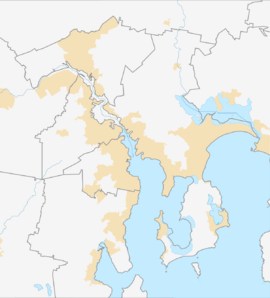
Huntingfield is a friendly residential area in Tasmania, Australia. It's part of the Kingborough region, which is near the city of Hobart. Huntingfield is located about 3 kilometers (2 miles) south-west of the town of Kingston. In 2021, about 540 people lived in Huntingfield.
This suburb is on the edge of the greater Hobart area. It shares borders with places like Blackmans Bay and Kingston. Huntingfield was developed in the late 1980s. It is home to schools like Tarremah Steiner School and St Aloysius Catholic College, as well as the Kingborough Family Church. In 2017, houses in Huntingfield were selling very quickly. This was because they were affordable and the area had good services.
A Look at Huntingfield's Past
Huntingfield is officially recognized as a locality. The first European visitor to this area was a botanist named Robert Brown in 1804. Later, the Lucas family settled here. For a long time, Huntingfield was mostly farmland.
From Farms to Homes
Things started to change in the late 1960s. Big bushfires affected the area. Also, changes in farming markets made it harder for farmers. The new Southern Outlet road to Hobart made it easier to travel. These changes led to more houses being built, turning the area from farms into a growing suburb.
Getting Around Huntingfield
The main road that helps people get to Huntingfield is called Channel Highway (Route B68). This road runs along the north-western side of the area. It connects to a roundabout at the northern tip, making it easy to drive into Huntingfield.


