
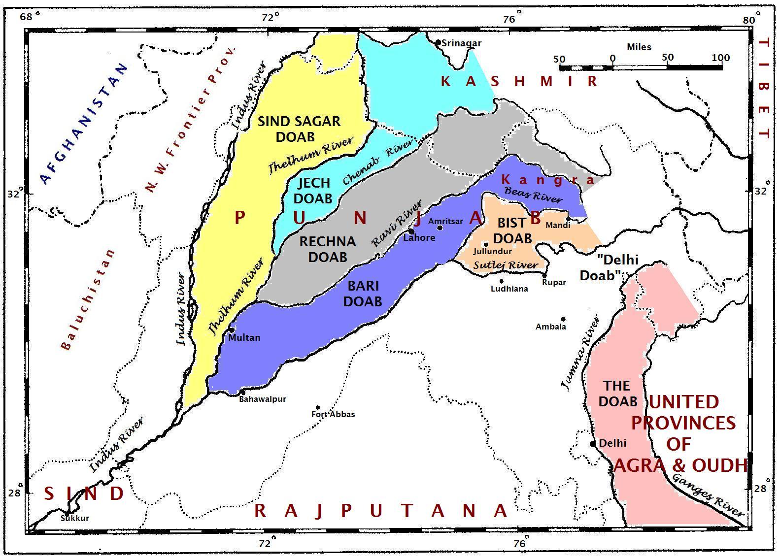
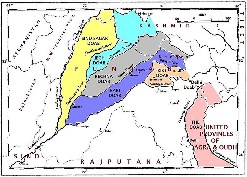
Image: Punjabdoabs1
Size of this preview: 800 × 574 pixels. Other resolutions: 320 × 229 pixels | 1,583 × 1,135 pixels.
Original image (1,583 × 1,135 pixels, file size: 268 KB, MIME type: image/jpeg)
Description: This map of the doabs is based on the map in the paper, "Partition of the Punjab and of Bengal," by O. H. G. Spate, The Geographical Journal, 110(4-6):201-218, November 1947. The journal was published in the United Kingdom.
Title: Punjabdoabs1
Credit: Own work
Author: Fowler&fowler
Usage Terms: Creative Commons Attribution-Share Alike 3.0
License: CC BY-SA 3.0
License Link: http://creativecommons.org/licenses/by-sa/3.0
Attribution Required?: Yes
Image usage
The following 7 pages link to this image:

All content from Kiddle encyclopedia articles (including the article images and facts) can be freely used under Attribution-ShareAlike license, unless stated otherwise.