
Image: Theoreticaltownshipmap
Size of this preview: 554 × 600 pixels. Other resolutions: 222 × 240 pixels | 694 × 751 pixels.
Original image (694 × 751 pixels, file size: 70 KB, MIME type: image/gif)
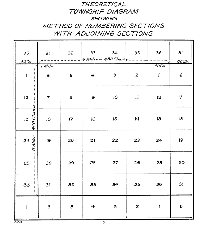
Description: The image depicts a standard survey township with its 36 sections and the correponding sections from the surrounding survey townships.
Title: Theoreticaltownshipmap
Credit: The image was tansferred from the en.wiki. If necessary, it could be found here.
Author: The image was done by the US Interior Bureau of Land Management Public domainPublic domainfalsefalse This image is a work of a Bureau of Land Management* employee, taken or made as part of that person's official duties. As a work of the U.S. federal government, the image is in the public domain in the United States. *or predecessor organization
Usage Terms: Public domain
License: Public domain
Attribution Required?: No
Image usage
The following 5 pages link to this image:

All content from Kiddle encyclopedia articles (including the article images and facts) can be freely used under Attribution-ShareAlike license, unless stated otherwise.