
Image: Undergroundrailroadsmall2
Size of this preview: 800 × 464 pixels. Other resolutions: 320 × 186 pixels | 1,035 × 600 pixels.
Original image (1,035 × 600 pixels, file size: 274 KB, MIME type: image/jpeg)
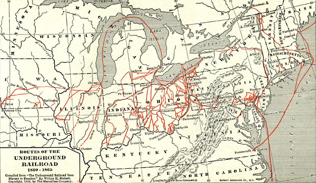
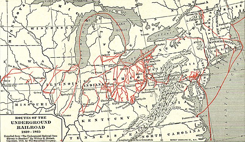
Description: "Routes of the Underground Railroad, 1830-1865." Whole map of the underground railroad. The Underground Railroad was not an actual railroad, but a network of secret routes and safe houses used by 19th-century black slaves in the United States to escape to free states and Canada.
Title: Undergroundrailroadsmall2
Credit: http://history.sandiego.edu/gen/CWPics/86139.jpg. Compiled from "The Underground Railroad from Slavery to Freedom" by Willbur H. Siebert Wilbur H. Siebert, The Macmillan Company, 1898.[1]
Usage Terms: Public domain
License: Public domain
Attribution Required?: No
Image usage
The following 12 pages link to this image:
- Alum Creek State Park
- Harriet Forten Purvis
- Hart Leavitt
- History of slavery in Illinois
- History of slavery in Maryland
- Isaac J. Rice
- List of Underground Railroad sites
- Midwestern United States
- Reverse Underground Railroad
- Underground Railroad
- Underground Railroad in Harrisburg, Pennsylvania
- Woodford County, Illinois

All content from Kiddle encyclopedia articles (including the article images and facts) can be freely used under Attribution-ShareAlike license, unless stated otherwise.