
Imperial, Texas facts for kids
Quick facts for kids
Imperial, Texas
|
|
|---|---|

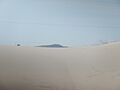
Sand dunes north of Imperial, Texas
|
|

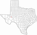
Location of Imperial, Texas
|
|
 |
|
| Country | United States |
| State | Texas |
| County | Pecos |
| Area | |
| • Total | 4.2 sq mi (11.0 km2) |
| • Land | 4.2 sq mi (11.0 km2) |
| • Water | 0.0 sq mi (0.0 km2) |
| Elevation | 2,392 ft (729 m) |
| Population
(2020)
|
|
| • Total | 294 |
| • Density | 70.0/sq mi (26.73/km2) |
| Time zone | UTC-6 (Central (CST)) |
| • Summer (DST) | UTC-5 (CDT) |
| ZIP code |
79743
|
| Area code(s) | 432 |
| FIPS code | 48-35828 |
| GNIS feature ID | 1359897 |
Imperial is a small community in Pecos County, Texas, United States. It is known as a census-designated place (CDP) because it's a special area counted by the government for population data. In 2020, about 294 people lived there.
Contents
Where is Imperial, Texas?
Imperial is located in northern Pecos County, Texas. You can find it where Farm Roads 11 and 1053 meet. It is about four miles south of the Pecos River. The community is also about 30 miles northeast of Fort Stockton.
According to the United States Census Bureau, Imperial covers a total area of about 4.2 square miles (11.0 square kilometers). All of this area is land.
A Brief History of Imperial
Imperial started as a community in the early 1900s. It was first called Redlands from 1908 to about 1910. Then, it was renamed Imperial, similar to the Imperial Valley in California.
In 1910, a post office and a school opened in Imperial. A year later, a townsite was planned on land owned by Benjamin E. Bush. People tried to bring water from the Pecos River to help with farming. They built a small dam and an irrigation canal. However, the river water had a lot of salt, which made farming difficult.
The population of Imperial was very small at first, with only about 25 people in the mid-1920s. By 1949, the number of residents had grown a lot. In the late 1960s, Imperial had almost 1,000 people and 26 businesses. After that, the population slowly started to decrease.
Who Lives in Imperial?
| Historical population | |||
|---|---|---|---|
| Census | Pop. | %± | |
| 2020 | 294 | — | |
| U.S. Decennial Census 1850–1900 1910 1920 1930 1940 1950 1960 1970 1980 1990 2000 2010 |
|||
Based on the census from 2000, there were 428 people living in Imperial. These people lived in 156 households, and 126 of these were families. The population density was about 101 people per square mile.
Most people in Imperial identified as White (79.21%). About 14.02% were from other races, and 4.21% were from two or more races. A significant part of the population, 36.92%, identified as Hispanic or Latino.
In terms of age, about 28.7% of the population was under 18 years old. About 14.3% were 65 years or older. The average age in Imperial was 40 years old.
The average income for a household in Imperial was $24,375. For families, the average income was $28,333. About 24.4% of the total population lived below the poverty line. This included 30.6% of those under 18.
Education in Imperial
Students in Imperial attend schools that are part of the Buena Vista Independent School District. The community is home to the Buena Vista High School, whose sports teams are known as the Longhorns.
Images for kids
-
Sand dunes north of Imperial, Texas
-
Location of Imperial, Texas
-

Location of Imperial within Pecos County
See also
 In Spanish: Imperial (Texas) para niños
