Ingalls, North Carolina facts for kids
Quick facts for kids
Ingalls
|
|
|---|---|
| Country | United States |
| State | North Carolina |
| County | Avery County |
| Named for | John James Ingalls |
| Elevation | 2,766 ft (843 m) |
| Time zone | UTC-5 (Eastern (EST)) |
| • Summer (DST) | UTC-4 (EDT) |
| ZIP code |
28657
|
| Area code(s) | 828 |
| GNIS feature ID | 1012354 |
Ingalls is a small place in Avery County, North Carolina, in the United States. It is known as an "unincorporated community." This means it does not have its own local government, like a city or town would. Instead, it is managed by the larger county government.
What is an Unincorporated Community?
An unincorporated community is a group of homes and businesses that share a name. They do not have their own mayor or city council. Services like roads, police, and fire protection are provided by the county. Ingalls is one such community.
Where is Ingalls Located?
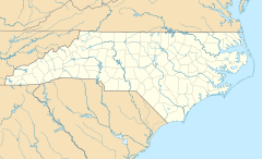
Ingalls is found in the western part of North Carolina. It sits in the beautiful Appalachian Mountains. The community is about 2,766 feet (843 meters) above sea level. This high elevation means it often has cooler weather.
Major Roads and Travel
The community is located where two important roads meet. These are US 19-E and NC 194. These roads help people travel to and from Ingalls.
Just two miles south of Ingalls, you can find the Avery County Airport. It is also known as Morrison Field. This airport helps connect the area to other places. It is located towards the town of Spruce Pine.
 | May Edward Chinn |
 | Rebecca Cole |
 | Alexa Canady |
 | Dorothy Lavinia Brown |


