Inuvik/Shell Lake Water Aerodrome facts for kids
Quick facts for kids
Inuvik/Shell Lake Water Aerodrome
|
|||||||||||
|---|---|---|---|---|---|---|---|---|---|---|---|
| Summary | |||||||||||
| Airport type | Public | ||||||||||
| Operator | North-Wright Airways | ||||||||||
| Location | Inuvik, Northwest Territories | ||||||||||
| Time zone | MST (UTC−07:00) | ||||||||||
| • Summer (DST) | MDT (UTC−06:00) | ||||||||||
| Elevation AMSL | 57 ft / 17 m | ||||||||||
| Coordinates | 68°19′28″N 133°38′04″W / 68.32444°N 133.63444°W | ||||||||||
| Map | |||||||||||
| Runway | |||||||||||
|
|||||||||||
|
Source: Water Aerodrome Supplement
|
|||||||||||
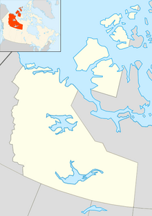
The Inuvik/Shell Lake Water Aerodrome is a special kind of airport for planes that land on water! It's found about 5 nautical miles (that's about 9 kilometers) southeast of Inuvik, a town in the Northwest Territories of Canada. This aerodrome is usually open during the warmer months, from June to September, when the water isn't frozen.
This aerodrome is an "airport of entry." This means that people flying in from other countries can land here and go through customs. The Canada Border Services Agency (CBSA) has officers at this aerodrome. They check people and goods entering Canada. However, they can only handle smaller planes with floats, carrying no more than 15 passengers.
Getting to Inuvik/Shell Lake Water Aerodrome
You can reach this water aerodrome by using the Dempster Highway. This highway is a famous road that connects many communities in Canada's northern regions.
More About Inuvik's Airports
 | Toni Morrison |
 | Barack Obama |
 | Martin Luther King Jr. |
 | Ralph Bunche |


