
Inveresk Roman Fort facts for kids
Quick facts for kids Inveresk Roman Fort |
|
|---|---|

Inveresk Parish Kirk, site of the Roman Fort
|
|

Location in East Lothian
|
|
| Structure | |
| — Stone? structure — | |
| Size and area | (2.7 ha) |
| Location | |
| Coordinates | 55°56′11″N 3°03′17″W / 55.9365°N 3.0546°W |
| Place name | Inveresk |
| County | East Lothian |
| Country | Scotland |
| Reference | |
| UK-OSNG reference | NT345722 |
The Inveresk Roman Fort is an ancient Roman army base. It is located in the village of Inveresk, in East Lothian, Scotland. Today, it is an archaeological site found within the grounds of St Michael's Church. Many digs have happened here since 1946. These digs have helped experts learn about the fort's shape and some of its inside areas.
Contents
What Was the Inveresk Roman Fort?
This Roman fort was quite large. It covered an area of about 6.6 acres (2.7 hectares). Because of its size, the first archaeologist to dig here, Ian Richmond, thought it might have held a cavalry regiment. A cavalry regiment is a group of soldiers who fight on horseback.
We don't know much about the buildings inside the fort yet. So, we can't be sure if it was a cavalry base. However, in 2007, a Roman tombstone was found nearby. It showed a Roman governor's guard cavalry soldier named "Crescens." He might have lived at the Inveresk fort.
When Did Romans Live Here?
All the old items found at Inveresk show that the fort was used during the Antonine period. This means it was built soon after the Roman emperor Antoninus Pius invaded Scotland. This invasion happened around AD 139 or 140.
Archaeologists have found signs of two different times the fort was used. This might mean that different groups of soldiers lived there over time. The fort was likely left empty around AD 160. This happened when the Romans decided to use Hadrian's Wall again as their northern border.
What Was Outside the Fort?
Outside the fort's eastern wall, there was a large civilian settlement. This kind of settlement was called a vicus by the Romans. It was like a small town where families of soldiers and traders lived.
Archaeologists also found a curved building in this settlement. They think it might have been an amphitheatre. An amphitheatre was a place where Romans watched shows and events.
What Was the Fort Called?
We don't know the exact Roman name for the Inveresk fort. Some people think it might have been called Curia. This name comes from an ancient map by Ptolemy, a famous geographer. He placed Curia in the land of the Votadini tribe. Some believe the name might have come from a local meeting place that the fort controlled. This meeting place could have been near Arthur's Seat, which is about 4 miles away.
Another old text, the Ravenna Cosmography, suggests the fort might have been called Evidensca.
Images for kids
-
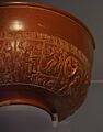
A Samian bowl found at Inveresk. This type of pottery was common in Roman times.

