Irwin, Ohio facts for kids
Quick facts for kids
Irwin, Ohio
|
|
|---|---|

Post office
|
|

Location of Irwin, Ohio
|
|
| Country | United States |
| State | Ohio |
| Counties | Union |
| Elevation | 1,011 ft (308 m) |
| Time zone | UTC-5 (Eastern (EST)) |
| • Summer (DST) | UTC-4 (EDT) |
| ZIP code |
43029
|
| Area code(s) | 614 |
| GNIS feature ID | 1064891 |
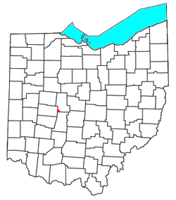
Irwin is a small, quiet community in Ohio, United States. It's not a city or a town, but an "unincorporated community." This means it's a place where people live, but it doesn't have its own local government like a city does. Irwin is located in Union County, in the southwestern part of Union Township.
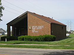
You can find Irwin where two main roads, Ohio State Route 4 and Ohio State Route 161, meet. Even though it's small, Irwin has its own post office. This post office helps people in the surrounding area, including a nearby community called Rosedale.
History of Irwin
The community of Irwin has a long history. A post office has been serving the people of Irwin since May 15, 1858. That's over 160 years ago!
The community was named after an early settler, a man known simply as Mr. Irwin. He was one of the first people to live in this area.
Near Irwin, you can find a historic farm called Elmwood Place. This special place is so important that it is listed on the National Register of Historic Places. This list includes buildings, sites, and objects that are important in American history.
 | Bessie Coleman |
 | Spann Watson |
 | Jill E. Brown |
 | Sherman W. White |

