Rosedale, Ohio facts for kids
Quick facts for kids
Rosedale, Ohio
|
|
|---|---|

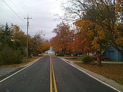
Rosedale, Ohio in Fall
|
|

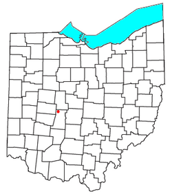
Location of Rosedale, Ohio
|
|
| Country | United States |
| State | Ohio |
| County | Madison |
| Township | Pike |
| Elevation | 1,011 ft (308 m) |
| Population
(2010)
|
|
| • Total | 580 |
| Time zone | UTC-5 (Eastern (EST)) |
| • Summer (DST) | UTC-4 (EDT) |
| ZIP codes |
43029
|
| Area code(s) | 740 |
| GNIS feature ID | 1065246 |
Rosedale is a small community in Ohio, United States. It's not officially a city or town, but a place where people live together. Rosedale is located in Madison County, about 30 miles (48 kilometers) west of the big city of Columbus.
Contents
History of Rosedale
Early Days and the Post Office
The first post office in Rosedale opened on June 3, 1830. A person named Captain Andrews was the very first postmaster. In 1832, Captain Andrews bought a lot of land, about 1,300 acres. He named this area "Rosedale Farms" after the post office. He also opened a store where two roads, Rosedale Road and Rosedale-Milford Center Road, met.
Later, in 1836, another person named Darius Burnham planned out a community nearby called Liverpool. He owned the land and recorded the plan in London. From 1837 to 1838, the post office moved from the countryside into Liverpool. Soon after, the community of Liverpool changed its name to Rosedale to match the post office.
The Rosedale Post Office closed down in 1867. It opened again in 1870 but then closed for good in 1901. After that, mail for Rosedale was sent through the Mechanicsburg post office.
Schools and Growth
In 1905, a new high school for Pike Township was built in Rosedale. It cost about $12,000 to build. By 1915, Rosedale had a general store, a blacksmith shop, and about 60 people living there.
Rosedale Bible College
In 1964, a school called Conservative Mennonite Bible School moved to Rosedale. This school is a Bible college, which means it teaches about the Bible and religious studies. It bought the old high school building. The school later changed its name to Rosedale Bible College. Around the same time, the main offices for the Conservative Mennonite Conference (now called the Rosedale Network of Churches) also moved to Rosedale.
Geography and Landscape
Rosedale is located between two parts of a stream called the Little Darby Creek. These parts are the Spring Fork and the main channel. This means Rosedale is on the western edge of the Scioto Watershed. A watershed is an area of land where all the water drains into a specific river or body of water.
This area used to be a wetland with tall prairie grass and trees that liked a lot of moisture. Today, the land is very rich and good for farming. Farmers in Rosedale mostly grow crops like soybeans, corn, and wheat.
Economy and Organizations
Rosedale is home to several important organizations connected to the Rosedale Network of Churches. These include:
- Rosedale Bible College: This is the college that moved into the old high school building.
- Choice Books Great Lakes-Rosedale: This organization helps distribute books.
- The main offices for the Conservative Mennonite Conference.
For many years, the mission agency of the Conference, Rosedale Mennonite Missions, was also located in Rosedale. However, in 2015, it moved to Columbus, Ohio and changed its name to Rosedale International. Rosedale also has one church, which is the Rosedale Free Will Baptist Church.
 | Audre Lorde |
 | John Berry Meachum |
 | Ferdinand Lee Barnett |

