
Iserhoff River facts for kids
Quick facts for kids Iserhoff |
|
|---|---|

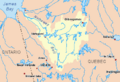
Watershed of Nottaway River
|
|
| Country | Canada |
| Province | Quebec |
| Region | Eeyou Istchee Baie-James (municipality) |
| Physical characteristics | |
| Main source | Little unidentified lake in mountains Eeyou Istchee Baie-James (municipality), Nord-du-Québec, Quebec 369 m (1,211 ft) 49°26′10″N 77°04′47″W / 49.43611°N 77.07972°W |
| River mouth | Lake Waswanipi Eeyou Istchee Baie-James (municipality), Nord-du-Québec, Quebec 267 m (876 ft) 49°29′43″N 76°39′36″W / 49.49528°N 76.66000°W |
| Length | 92.0 km (57.2 mi) |
| Basin features | |
| Tributaries |
|
The Iserhoff River is a river in Quebec, Canada. It flows into Lake Waswanipi in the Eeyou Istchee Baie-James (municipality) area of Nord-du-Québec.
The river flows through different areas called townships: Desjardins, Berthiaume, and Bergeres. You can reach the area around the Iserhoff River using roads R1026 and R1018. These roads connect to road 113 in the south, which links Lebel-sur-Quévillon to Chibougamau.
The Iserhoff River usually freezes over from early November to mid-May. However, it's generally safe to travel on the ice from mid-November to mid-April.
Contents
Where Does the Iserhoff River Flow?
The Iserhoff River starts from a small lake in the mountains. This lake is about 369 meters (1,211 feet) above sea level.
Here's how far the source is from other important places:
- 31.1 km (19.3 miles) southwest of where the Iserhoff River meets Lake Waswanipi.
- 48.6 km (30.2 miles) southwest of where Lake Waswanipi flows into the Waswanipi River.
- 53.9 km (33.5 miles) southeast of downtown Matagami.
From its source, the Iserhoff River flows for about 92.0 km (57.2 miles).
The River's Journey
The river's journey can be split into two main parts:
Upper Iserhoff River (78.3 km or 48.7 miles)
- It flows northeast for 3.1 km (1.9 miles) in the Desjardins township.
- Then it turns east for 20.1 km (12.5 miles) in the Berthiaume township, passing south of Mount Kitci.
- It continues northeast for 4.7 km (2.9 miles) in the Bergères township, where two streams join it.
- Finally, it flows northeast and then north for 8.1 km (5.0 miles) until it reaches Imbault Brook.
Lower Iserhoff River (13.7 km or 8.5 miles)
- It flows east for 5.1 km (3.2 miles) to where the Iserhoff North River joins it.
- It continues east for another 5.1 km (3.2 miles) to the R1018 forest road bridge.
- The last 3.5 km (2.2 miles) wind through a marshy area before it reaches its mouth.
The Iserhoff River empties into the Southwest Bay of Lake Waswanipi. From there, the water flows east, then north through Lake Waswanipi. After that, it travels north through the Waswanipi River, then west to Goéland Lake. The Waswanipi River then flows through Goéland Lake and eventually into Lake Matagami.
Where the River Ends
The mouth of the Iserhoff River is located:
- 21.7 km (13.5 miles) southwest of the mouth of Lake Waswanipi.
- 59.9 km (37.2 miles) southwest of the village of Waswanipi.
What's in a Name?
The name "Iserhoff River" first appeared on a map in 1896. It was named after a missionary who worked in the region in the 1800s. In 1905, his presence was noted at Fort Eastmain.
There's also a part of Mistassini Lake called Baie Iserhoff. This bay is named after Charles Iserhoff, who was the missionary's nephew. Charles worked for the Hudson's Bay Company at a trading post that is now the Cree village of Mistissini.
The name "Iserhoff River" is mentioned in old books about Quebec's rivers and lakes from 1914 and 1925. In 1946, a person named Mrs. Wilfrid Jefferys (born Iserhoff) shared that her Métis family had always lived near Lake Mistassini or the Waswanipi station.
The Cree community calls this river "Packîwâgâ Sîbî." This means "river digs the bank, so that there is an overhang."
The official name "Iserhoff River" was formally recognized on December 5, 1968, by the Commission de toponymie du Québec.
Images for kids
-
Watershed of Nottaway River
