Jeremy Ranch, Utah facts for kids
Quick facts for kids
Jeremy Ranch
Formerly known as Gorgoza
|
|
|---|---|
|
Community
|
|

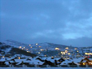
Jeremy Ranch on a winter evening in December 2006
|
|
| Country | United States |
| State | Utah |
| County | Summit |
| Census-designated place | Summit Park |
| Elevation | 6,434 ft (1,961 m) |
| ZIP code |
84098
|
| GNIS feature ID | 1435770 |
Jeremy Ranch is a friendly community located in Summit County, Utah, United States. It is part of a larger area called Summit Park, which is a special type of place defined by the United States Census Bureau for gathering information.
About Jeremy Ranch
Jeremy Ranch is nestled in a beautiful spot called Toll Canyon. This area is also at the beginning of East Canyon. It sits right along Interstate 80, a major highway.
Where is Jeremy Ranch Located?
This community is about 9 miles (14.5 km) northwest of the popular ski town of Park City. It's also about 15 miles (24 km) east of Salt Lake City, Utah's capital. Long ago, this area was known by a different name: Gorgoza. A stream called East Canyon Creek flows through the community, heading northwest through East Canyon.
What Can You Find There?
Jeremy Ranch is well-known for its fantastic golf course. This course was designed by the famous golfer Arnold Palmer. The community is quite high up, sitting at an elevation of about 6,400 feet (1,950 meters). It's located in the Wasatch Range, which is part of the larger Rocky Mountains. The Jeremy Ranch Elementary School, which is part of the Park City School District, is also located right within the community.
 | Jackie Robinson |
 | Jack Johnson |
 | Althea Gibson |
 | Arthur Ashe |
 | Muhammad Ali |


