Johnson's Shut-Ins State Park facts for kids
Quick facts for kids Johnson's Shut-Ins State Park |
|
|---|---|

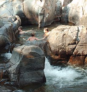
A portion of the park's natural water park pictured after the 2009 reopening
|
|
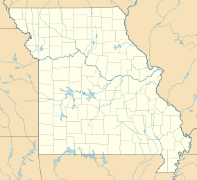
| Location | Reynolds County, Missouri, United States |
| Area | 8,780.51 acres (35.5335 km2) |
| Elevation | 1,106 ft (337 m) |
| Designation | Missouri state park |
| Established | 1955 |
| Visitors | 373,204 (in 2017) |
| Administrator | Missouri Department of Natural Resources |
| Website | Johnson's Shut-Ins State Park |
Johnson's Shut-Ins State Park is a fun outdoor area in Reynolds County, Missouri. It covers about 8,781 acres along the East Fork Black River. This park is managed together with Taum Sauk Mountain State Park. Together, these two parks make up a huge natural space. They are located in the St. Francois Mountains within the Ozarks region of Missouri.
The special name "shut-in" describes a spot where a river flows through very hard rock. This rock resists being worn away by the water. At Johnson's Shut-Ins, the river rushes over and around smooth, ancient rocks. This creates a natural water park that visitors love to explore. It's a great place to swim and play when the water levels are safe.
Contents
Geology: How the Shut-Ins Formed
The rocks in this area are very old and very strong. They are made of rhyolite and dark diabase rock. These rocks formed millions of years ago. The East Fork Black River became "shut-in" because it was forced into a narrow path. This path followed natural cracks in the hard rock.
Over a very long time, sand and gravel carried by the river carved into these tough rocks. This created deep potholes, slides, and canyon-like areas. These are the unique features you see at the park today.
History of Johnson's Shut-Ins
Early History and Park Creation
Long ago, the Osage Nation used to hunt in this area. Later, in the mid-1800s, the Johnston family settled here. They were immigrants from the Appalachian Mountains.
Three generations later, the Johnston family sold their land. Most of it was bought by Joseph Desloge. He was a leader from St. Louis who cared a lot about nature. Mr. Desloge spent 17 years buying up land. He gathered most of what is now the park, including the famous shut-ins. In 1955, he gave this land to the state of Missouri. His family, who were involved in lead mining, continued to help the park. They donated money for improvements over the years.
The 2005 Flood and Park Recovery
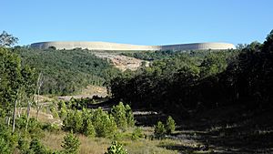
On December 14, 2005, the park faced a huge challenge. A large reservoir on a nearby mountain broke. This caused a massive flood that rushed through the park. Luckily, the park's campground was empty at the time. The park superintendent and his family, who lived there, were safe.
The flood caused a lot of damage. The park had to close for a while. In the summer of 2006, parts of the park reopened for day visits. However, it was still too dangerous to swim or explore the rocks. By 2009, the river and shut-ins were safe for water fun again. A brand new campground opened in 2010. Money for fixing the park came from a settlement with the company that owned the reservoir.
The 2009 Windstorm
In May 2009, a strong windstorm, called a derecho, hit the park. Winds reached up to 70 miles per hour, and some gusts were even stronger. This storm damaged many trees in the park and the surrounding area.
Activities and Things to Do
Johnson's Shut-Ins State Park offers many fun activities. You can go camping, hiking, swimming, and even rock climbing.
There are several trails to explore:
- A paved path about a quarter-mile long leads to a viewing deck. From here, you can see the amazing shut-ins.
- The Goggins Mountain Equestrian Trail is a 10-mile loop for horseback riding.
- A section of the Ozark Trail also runs through the park.
You can also take a special auto tour. This drive shows you how the park is recovering from the flood. It also passes by special areas called fens, which are wetlands that were restored. The tour ends at a shaded spot where you can see the path the flood took. From there, you can walk through a field of boulders left by the flood. This boulder field is a great place to see different types of rocks and minerals from the St. Francois Mountains.
 | Sharif Bey |
 | Hale Woodruff |
 | Richmond Barthé |
 | Purvis Young |


