Johnson City, Kansas facts for kids
Quick facts for kids
Johnson City, Kansas
|
|
|---|---|
|
City and County seat
|
|

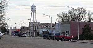
Downtown Main Street (facing south) (2010)
|
|

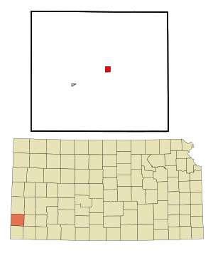
Location with Stanton County and Kansas
|
|

|
|
| Country | United States |
| State | Kansas |
| County | Stanton |
| Founded | 1885 |
| Incorporated | 1888 |
| Named for | A.S. Johnson |
| Area | |
| • Total | 2.14 sq mi (5.55 km2) |
| • Land | 2.14 sq mi (5.55 km2) |
| • Water | 0.00 sq mi (0.00 km2) |
| Elevation | 3,333 ft (1,016 m) |
| Population
(2020)
|
|
| • Total | 1,464 |
| • Density | 684.1/sq mi (263.8/km2) |
| Time zone | UTC-6 (CST) |
| • Summer (DST) | UTC-5 (CDT) |
| ZIP code |
67855
|
| Area code | 620 |
| FIPS code | 20-35575 |
| GNIS ID | 2395473 |
Johnson City is a small city in Kansas, United States. It's the main town, or county seat, of Stanton County. This means it's where the county government offices are located. In 2020, about 1,464 people lived there.
Contents
History of Johnson City
Johnson City was started in 1885. It was first called Veteran. This was because many of the people who founded it were soldiers from the Civil War.
The city was renamed Johnson City in 1886. It was named after A. S. Johnson, who worked for a railroad company.
Geography and Climate
Johnson City covers an area of about 2.01 square miles (5.2 square kilometers). All of this area is land.
Understanding the Climate
Johnson City has a semi-arid climate. This means it's usually dry, but not a true desert. It gets some rain, but not a lot.
| Climate data for Johnson City, Kansas (1991–2020 normals, extremes 1995–present) | |||||||||||||
|---|---|---|---|---|---|---|---|---|---|---|---|---|---|
| Month | Jan | Feb | Mar | Apr | May | Jun | Jul | Aug | Sep | Oct | Nov | Dec | Year |
| Record high °F (°C) | 82 (28) |
88 (31) |
92 (33) |
96 (36) |
104 (40) |
109 (43) |
108 (42) |
106 (41) |
106 (41) |
99 (37) |
90 (32) |
79 (26) |
109 (43) |
| Mean daily maximum °F (°C) | 47.4 (8.6) |
51.0 (10.6) |
60.3 (15.7) |
68.4 (20.2) |
78.4 (25.8) |
89.0 (31.7) |
93.4 (34.1) |
90.5 (32.5) |
84.0 (28.9) |
71.5 (21.9) |
58.4 (14.7) |
47.6 (8.7) |
70.0 (21.1) |
| Daily mean °F (°C) | 33.8 (1.0) |
36.8 (2.7) |
45.2 (7.3) |
53.5 (11.9) |
64.0 (17.8) |
74.8 (23.8) |
79.5 (26.4) |
77.2 (25.1) |
69.6 (20.9) |
56.4 (13.6) |
44.2 (6.8) |
34.5 (1.4) |
55.8 (13.2) |
| Mean daily minimum °F (°C) | 20.2 (−6.6) |
22.7 (−5.2) |
30.1 (−1.1) |
38.5 (3.6) |
49.6 (9.8) |
60.6 (15.9) |
65.7 (18.7) |
63.9 (17.7) |
55.2 (12.9) |
41.3 (5.2) |
29.9 (−1.2) |
21.5 (−5.8) |
41.6 (5.3) |
| Record low °F (°C) | −6 (−21) |
−18 (−28) |
−3 (−19) |
13 (−11) |
27 (−3) |
42 (6) |
51 (11) |
51 (11) |
31 (−1) |
7 (−14) |
2 (−17) |
−16 (−27) |
−18 (−28) |
| Average precipitation inches (mm) | 0.51 (13) |
0.34 (8.6) |
0.97 (25) |
1.46 (37) |
2.01 (51) |
2.19 (56) |
2.86 (73) |
3.02 (77) |
1.37 (35) |
1.55 (39) |
0.51 (13) |
0.68 (17) |
17.47 (444) |
| Average snowfall inches (cm) | 5.8 (15) |
3.2 (8.1) |
4.7 (12) |
0.9 (2.3) |
0.0 (0.0) |
0.0 (0.0) |
0.0 (0.0) |
0.0 (0.0) |
0.0 (0.0) |
0.7 (1.8) |
1.3 (3.3) |
5.3 (13) |
21.9 (56) |
| Average precipitation days (≥ 0.01 in) | 2.5 | 3.0 | 4.2 | 5.7 | 6.6 | 6.9 | 8.6 | 6.7 | 4.0 | 4.2 | 2.4 | 3.1 | 57.9 |
| Average snowy days (≥ 0.1 in) | 1.9 | 2.0 | 1.8 | 0.4 | 0.0 | 0.0 | 0.0 | 0.0 | 0.0 | 0.2 | 0.8 | 2.6 | 9.7 |
| Source: NOAA | |||||||||||||
People of Johnson City
| Historical population | |||
|---|---|---|---|
| Census | Pop. | %± | |
| 1890 | 143 | — | |
| 1930 | 514 | — | |
| 1940 | 524 | 1.9% | |
| 1950 | 994 | 89.7% | |
| 1960 | 860 | −13.5% | |
| 1970 | 1,038 | 20.7% | |
| 1980 | 1,244 | 19.8% | |
| 1990 | 1,348 | 8.4% | |
| 2000 | 1,528 | 13.4% | |
| 2010 | 1,495 | −2.2% | |
| 2020 | 1,464 | −2.1% | |
| U.S. Decennial Census | |||
Population in 2020
In 2020, Johnson City had 1,464 people living there. There were 531 households. A household is a group of people living in one home.
About 28.6% of the people were under 18 years old. Around 15.4% were 65 years or older. The average age was 34.4 years.
Population in 2010
In 2010, there were 1,495 people living in Johnson City. There were 533 households.
About 29.8% of the people were under 18 years old. Around 13.8% were 65 years or older. The average age was 33.9 years.
Fun Places to Visit
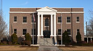
- Stanton County Museum
Education
Students in Johnson City go to schools in the Stanton County USD 452 public school district. The high school team is called the Stanton County Trojans.
Getting Around
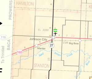
Johnson City is located near two main highways. U.S. Highway 160 runs east and west just north of the city. State Highway 27 and U.S. Highway 160 also run north and south along the west side of Johnson City.
The closest airport is Stanton County Municipal Airport. It's about 21 miles north of Richfield.
See also
 In Spanish: Johnson City (Kansas) para niños


