Juchitán de Zaragoza facts for kids
Quick facts for kids
Juchitán de Zaragoza
|
|
|---|---|
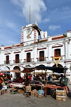
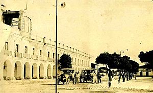
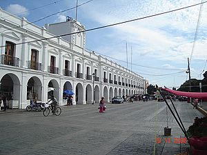
The Town Hall.
Damage from the 2017 earthquake is visible |
|
| Country | |
| State | Oaxaca |
| Municipality | Juchitán de Zaragoza |
| Founded | 1486 Cosijopí (Zapotec king) |
| Area | |
| • Town | 16.4 km2 (6.3 sq mi) |
| • Municipality | 415 km2 (160.1 sq mi) |
| Elevation | 30 m (100 ft) |
| Population
(2020 census)
|
|
| • Town | 88,280 |
| • Town density | 5,383/km2 (13,940/sq mi) |
| • Municipality | 113,570 |
| • Municipality density | 273.89/km2 (709.37/sq mi) |
| Demonym(s) | Juchiteco(a) |
| Time zone | UTC-6 (Central (US Central)) |
| • Summer (DST) | UTC-5 (Central) |
| Postal code |
70000
|
| Area code(s) | 971 |
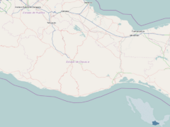
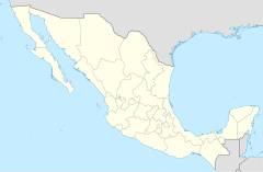
Juchitán de Zaragoza is a town in the southeast of Oaxaca, a state in Mexico. Its name in the local Isthmus Zapotec language is Xabizende. It is part of the Istmo de Tehuantepec region.
In 2020, about 88,280 people lived there, making it the third-largest city in Oaxaca. Most of the people are Zapotec and Huave indigenous groups. The town is also the main center for the surrounding municipality, which shares its name. The municipality covers 414.64 square kilometers (160.1 sq mi) and has a population of 113,570.
Juchitán is located 26 kilometers (16 miles) northeast of Tehuantepec. Its Town Hall (Palacio Municipal) was built in the mid-1800s. It might be the widest "palace" in Mexico, with 31 arches at its front. The main church, Parroquia de San Vicente Ferrer, dates back to the 1600s. West of the Town Hall is a large market where you can find local products and hear the local Zapotec language spoken.
Contents
History of Juchitán
The people of Juchitán have a history of standing up for their rights. In 1834, a local leader named "Che Gorio Melendre" led a revolt. They wanted control of the salt mines on the coast and more local independence. This revolt was paused by the Mexican–American War in 1847. Melendre's troops joined the fight against the invasion.
After the United States invasion, the governor of Oaxaca, Benito Juárez, responded to Melendre's demands. On May 19, 1850, he sent troops to burn Juchitán and kill Melendre.
Defending Against Invasion
On September 5, 1866, during the French invasion of Mexico, the local people fought back. Indigenous groups from Juchitán and nearby towns defeated the French Army. Many soldiers in the army of Porfirio Díaz, who later became President of Mexico, were from Juchitán.
In 1910, José Fructuoso Gómez, known as Che Gómez, led another revolt. He supported the Mexican Revolution alongside leaders like Emiliano Zapata and Pancho Villa. Later, in the 1970s, groups of students, workers, and farmers worked to gain local control through elections, not by force. In 2001, the Zapatista Army of National Liberation (EZLN) visited Juchitán.
Strategic Location and Development
Juchitán's history is also shaped by its location on the Isthmus of Tehuantepec. This is a narrow part of Mexico between the Pacific Ocean and the Gulf of Mexico. Many countries have been interested in this area for trade routes. For example, the McLane–Ocampo Treaty in 1859 allowed the United States to use the isthmus.
Today, companies like Gamesa and Iberdrola are investing in Juchitán. They are building a large wind power park called Proyecto La Venta II. This project aims to produce at least 88 megawatts of power. It could make Juchitán a leader in clean energy for Latin America. However, some people have concerns about how this project might affect the local environment and culture.
In 2006, Juchitán was officially renamed "Heroic City of Juchitán de Zaragoza." This was done by the State Congress to honor its people's bravery against the French invasion.
In February 2021, an agreement was made to operate a 540 kV solar power plant. This plant will provide electricity to a community that had been without it for ten years.
The 2017 Chiapas Earthquake
On September 7, 2017, a very strong earthquake hit off the coast of Chiapas. It was one of the strongest earthquakes in Mexico in a century.
Juchitán de Zaragoza was one of the most affected cities. Many streets were destroyed. The historic Town Hall, built in 1860, was badly damaged, with a large part of it collapsing. After the earthquake, a resident placed the Mexican flag on top of the rubble. This image became a powerful symbol of hope and unity for the country.
Culture and Traditions
The people of Juchitán are known for their contributions to the arts. This includes painting, poetry, music, folk dance, and sculpture.
In May, residents celebrate the Fiesta de las Velas (Festival of the Candles). This festival honors their patron saint, San Vicente Ferrer, with a large procession.
The Isthmus Zapotec people make up about 70 percent of Juchitán's population. They blend Catholic and indigenous spiritual traditions. They use flowers, processions, and prayers in rituals. These rituals help protect and guide spirits on their journey after death. They also celebrate the Day of the Dead and Holy Week.
Juchitán is also known for its acceptance and respect for LGBTQ people in Mexico. This is due to the traditional Zapotec culture of muxes, who are people assigned male at birth but who adopt roles and identities traditionally associated with women. This shows the community's openness.
Geography and Climate
Climate in Juchitán
| Month | Jan | Feb | Mar | Apr | May | Jun | Jul | Aug | Sep | Oct | Nov | Dec | Year |
|---|---|---|---|---|---|---|---|---|---|---|---|---|---|
| Record high °C (°F) | 40.5 (104.9) |
41.5 (106.7) |
40.0 (104.0) |
46.0 (114.8) |
45.0 (113.0) |
41.0 (105.8) |
42.0 (107.6) |
42.0 (107.6) |
42.0 (107.6) |
42.0 (107.6) |
43.0 (109.4) |
40.5 (104.9) |
46.0 (114.8) |
| Mean daily maximum °C (°F) | 29.8 (85.6) |
31.0 (87.8) |
32.4 (90.3) |
34.0 (93.2) |
34.7 (94.5) |
32.9 (91.2) |
32.6 (90.7) |
33.0 (91.4) |
32.2 (90.0) |
31.4 (88.5) |
30.9 (87.6) |
30.0 (86.0) |
32.1 (89.8) |
| Daily mean °C (°F) | 24.9 (76.8) |
25.5 (77.9) |
26.9 (80.4) |
28.6 (83.5) |
29.4 (84.9) |
28.2 (82.8) |
27.9 (82.2) |
28.1 (82.6) |
27.5 (81.5) |
26.9 (80.4) |
26.4 (79.5) |
25.4 (77.7) |
27.1 (80.8) |
| Mean daily minimum °C (°F) | 19.9 (67.8) |
20.0 (68.0) |
21.4 (70.5) |
23.1 (73.6) |
24.0 (75.2) |
23.4 (74.1) |
23.2 (73.8) |
23.3 (73.9) |
22.9 (73.2) |
22.5 (72.5) |
21.8 (71.2) |
20.7 (69.3) |
22.2 (72.0) |
| Record low °C (°F) | 12.0 (53.6) |
10.0 (50.0) |
11.5 (52.7) |
11.0 (51.8) |
15.0 (59.0) |
15.0 (59.0) |
11.5 (52.7) |
14.5 (58.1) |
12.0 (53.6) |
16.0 (60.8) |
13.0 (55.4) |
10.6 (51.1) |
10.0 (50.0) |
| Average precipitation mm (inches) | 7.2 (0.28) |
3.6 (0.14) |
5.8 (0.23) |
5.8 (0.23) |
58.9 (2.32) |
228.1 (8.98) |
159.7 (6.29) |
169.6 (6.68) |
239.0 (9.41) |
75.0 (2.95) |
20.1 (0.79) |
5.6 (0.22) |
978.4 (38.52) |
| Average precipitation days (≥ 0.1 mm) | 1.0 | 0.5 | 0.6 | 0.6 | 4.1 | 11.8 | 8.5 | 8.8 | 11.2 | 4.7 | 1.2 | 0.5 | 53.5 |
| Source: Servicio Meteorológico National | |||||||||||||
The Municipality of Juchitán
As the main town, Juchitán oversees many smaller communities. These include:
- 15 de Agosto
- 5 de Septiembre
- Álvaro Obregón
- Cerro Cristo
- Charis
- Chicapa de Castro
- Colonia 19 de Marzo (Colonia San José)
- Colonia de la Amistad
- Colonia Jesús González Cortaza
- Colonia José Yola
- Colonia Mariano Montero
- Colonia San Vicente
- Colonia Santa Rosita
- Dos Arbolitos
- Dos Hermanos
- El Caballero Burro
- El Chamizal (Toledo Cueto)
- El Chaparral
- El Porvenir
- El Tamarindo
- Emiliano Zapata
- Esquipulas 1
- Esquipulas 2
- Estero Guiee
- Gaspar Torres Urbieta
- Huanacastal
- La Esperanza
- La Estancia (Santa Cecilia)
- La Guadalupana
- La Liebre (Paraje la Liebre)
- La Negrita
- La Providencia
- La Venta
- La Ventosa 1
- La Ventosa 2
- Los Aguacates
- Los Cocos
- Los Ordaz II
- Los Vicentes
- Minerva
- Onésimas (Argelino Solórzano)
- Parada San Vicente
- Pepe y Lolita
- Piedra Larga
- Playa San Vicente
- Primera Curva
- Rancho Adelma
- Rancho Babel López Sánchez
- Rancho Chuvalessa
- Rancho de los Vásquez (Colonia Palomar)
- Rancho Domitilo Marquez
- Rancho Don Cutberto
- Rancho el Ángel
- Rancho Esquipulas
- Rancho Francisco
- Rancho Guadalupe
- Rancho Juanita
- Rancho Lucita
- Rancho Martín Vicente
- Rancho Nemesio Valdivieso López
- Rancho San Antonio
- Rancho San Luis
- Rancho Torres
- Río Viejo (Mojonera)
- Salinas Santa Cruz
- San Antonio
- San Isidro
- San José
- Santa Clara
- Santa Fe 1
- Santa Fe 2
- Santa Lucía
- Santa María del Mar
- Santa Rita
See also
 In Spanish: Juchitán de Zaragoza para niños
 | Frances Mary Albrier |
 | Whitney Young |
 | Muhammad Ali |


