Kailua-Kona, Hawaii facts for kids
Quick facts for kids
Kailua-Kona
Kailua-Kona (Hawaii County)
|
|
|---|---|
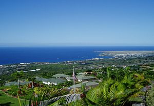
Kailua-Kona from Holualoa
|
|
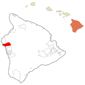
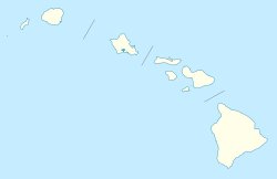
Location in Hawaii County and the state of Hawaii
|
|
| Area | |
| • Total | 19.19 sq mi (49.71 km2) |
| • Land | 13.80 sq mi (35.73 km2) |
| • Water | 5.40 sq mi (13.98 km2) |
| Elevation | 7 ft (2 m) |
| Population
(2020)
|
|
| • Total | 19,713 |
| • Density | 1,428.79/sq mi (551.66/km2) |
| Time zone | UTC−10 (Hawaii–Aleutian) |
| ZIP code |
96740
|
| Area code(s) | 808 |
| FIPS code | 15-23000 |
| GNIS feature ID | 365355 |
Kailua-Kona is a town in Hawaii County, Hawaii, United States. People often call it simply Kona or Kona Town. It shares the name Kailua with another town on Oʻahu.
Kailua-Kona is the second-largest town on the island of Hawaii. It is the biggest town on the island's west side. It is a major center for business and tourism. Kona International Airport serves the town. In 2020, about 19,713 people lived there.
The town was very close to the center of a big earthquake in 2006. For the 2020 census, the town's borders changed a bit. Some parts moved to a nearby area called Holualoa.
Contents
History of Kailua-Kona
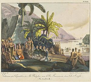
King Kamehameha I started this community. He made it his main place of government. This was before he united all the Hawaiian islands in 1795. Later, it became the capital of the new Kingdom of Hawaiʻi. The capital then moved to Lāhainā and later to Honolulu.
The town was a favorite spot for the Hawaiian royal family to relax. Until the late 1800s, Kailua-Kona was mostly a small fishing village. In recent years, the area has grown a lot. This growth is thanks to tourism and new buildings.
In 2014, the Pālamanui Community Forest was created here. Its goal is to protect Hawaii's native trees.
Geography and Climate
Kailua-Kona is located on the coast of Kailua Bay. It sits on the southern slope of the Hualālai volcano. There are no big rivers or streams in the town.
The town covers about 103.3 square kilometers (40 square miles). Most of this area is land, and a small part is water. Kailua-Kona is next to Kalaoa to the north. To the south is Holualoa. The Pacific Ocean is to the west.
Weather in Kailua-Kona
Kailua-Kona has a tropical, semi-arid climate. This means it's warm all year round. February is usually the coolest month. August is the warmest. It is one of the warmest places in the United States in January. The lowest temperature ever recorded here was 56°F (13°C).
The air is usually dry, with about 19 inches (48 cm) of rain each year. Mornings are often clear and sunny. Later in the day, clouds form, which can make it warmer.
Sometimes, a hazy air called Vog can cover the Kona coast. This happens when the Kilauea volcano is active. Kailua-Kona is on the side of the Hualalai Volcano that is protected from strong winds and rain.
| Climate data for Kailua Kona, Hawaii (1981–2010 normals) | |||||||||||||
|---|---|---|---|---|---|---|---|---|---|---|---|---|---|
| Month | Jan | Feb | Mar | Apr | May | Jun | Jul | Aug | Sep | Oct | Nov | Dec | Year |
| Record high °F (°C) | 90 (32) |
90 (32) |
91 (33) |
90 (32) |
92 (33) |
92 (33) |
93 (34) |
95 (35) |
94 (34) |
94 (34) |
92 (33) |
89 (32) |
95 (35) |
| Mean daily maximum °F (°C) | 81.6 (27.6) |
81.2 (27.3) |
82.2 (27.9) |
83.0 (28.3) |
83.5 (28.6) |
85.0 (29.4) |
86.0 (30.0) |
86.9 (30.5) |
86.8 (30.4) |
86.0 (30.0) |
84.2 (29.0) |
82.5 (28.1) |
84.1 (28.9) |
| Mean daily minimum °F (°C) | 68.2 (20.1) |
68.0 (20.0) |
70.0 (21.1) |
70.6 (21.4) |
71.6 (22.0) |
73.6 (23.1) |
74.1 (23.4) |
75.1 (23.9) |
74.6 (23.7) |
74.1 (23.4) |
71.8 (22.1) |
69.4 (20.8) |
71.8 (22.1) |
| Record low °F (°C) | 56 (13) |
58 (14) |
58 (14) |
60 (16) |
64 (18) |
62 (17) |
65 (18) |
58 (14) |
57 (14) |
57 (14) |
62 (17) |
60 (16) |
56 (13) |
| Average precipitation inches (mm) | 2.41 (61) |
1.50 (38) |
1.78 (45) |
1.36 (35) |
2.00 (51) |
0.97 (25) |
0.70 (18) |
1.39 (35) |
0.84 (21) |
1.34 (34) |
1.28 (33) |
2.82 (72) |
18.39 (468) |
| Source: WRCC/NCDC | |||||||||||||
Economy and Growth
Kailua-Kona faced a tough time during the 2008 financial crisis. But in the early 2010s, it started to grow a lot. Tourism also slowed down but has since bounced back. The number of visitors arriving by plane increased greatly from 2010 to 2017.
A new campus for Hawaiʻi Community College opened here in 2015. This is part of the University of Hawaiʻi.
Since May 2018, the air in Kailua-Kona has become much clearer. This is because the Kilauea volcano stopped releasing as much vog.
Fun Things to Do and See
Kailua-Kona hosts several exciting events:
- The annual Ironman World Championship triathlon.
- The yearly Kona Coffee Festival.
- The Hawaiian International Billfish Tournament.
Kona coffee is a special type of coffee grown on the slopes of Hualālai and Mauna Loa volcanoes. You can learn about coffee history at the Kona Coffee Living History Farm. There is also the H.N. Greenwell Store Museum nearby.
Ali'i Drive is the main street along the ocean in Kailua-Kona. It is also known as the "Royal Footsteps Along the Kona Coast." This scenic road has many old archaeological sites.
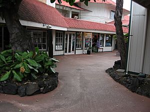
Near the pier, you can find the Kamakahonu royal residence and Ahuʻena Heiau (an ancient Hawaiian temple). The King Kamehameha's Kona Beach Hotel is also there. Another royal home is Huliheʻe Palace. Hawaiian royal family members used it until 1914. The Historic Kona Inn and other shops are also on Ali'i Drive.
Churches along the drive include:
- Mokuaikaua Church, Hawaii's first Christian church, started in 1820.
- Saint Michael the Archangel Catholic Church.
- Living Stones Church, an old building used by Christian missionaries.
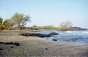
Popular beaches include La'aloa Bay (also called Magic Sands or White Sands Beach). Kahaluʻu Bay is a great spot for snorkeling.
You can take boat tours from Kailua-Kona pier or nearby harbors. These tours let you watch dolphins and whales. You can also swim with manta rays, turtles, and fish.
Education in Kailua-Kona
The Hawaii Department of Education runs the public schools in Kailua-Kona. These include:
- Kealakehe Elementary School
- Kahakai Elementary School
- Kealakehe Intermediate School
- Kealakehe High School
The University of the Nations, a training center for Youth With A Mission, is also in Kailua-Kona.
Notable People
- Pepper, a reggae rock band.
See also
 In Spanish: Kailua (condado de Hawái) para niños


