Kanaka Creek facts for kids
Quick facts for kids Kanaka Creek |
|
|---|---|

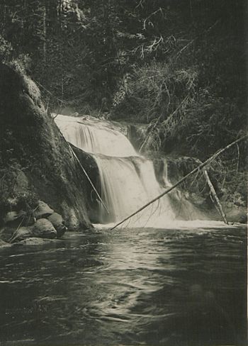
South Kanaka Creek Falls, near Websters Corners, 1915
|
|
| Country | Canada |
| Province | British Columbia |
| Physical characteristics | |
| Main source | Coast Mountains 920 m (3,020 ft) 49°16′47″N 122°25′46″W / 49.27972°N 122.42944°W |
| River mouth | Fraser River Maple Ridge, Metro Vancouver 6 m (20 ft) 49°12′2″N 122°35′9″W / 49.20056°N 122.58583°W |
| Basin features | |
| Basin size | 47.7 km2 (18.4 sq mi) |
Kanaka Creek is a stream in British Columbia, Canada. It flows into the Fraser River. This creek is located in Maple Ridge, which is a community in the Metro Vancouver area.
Kanaka Creek is an important part of the local environment. It is known for its natural beauty and the park that surrounds it. The creek's name has an interesting history, connecting to early settlers in the region.
What's in a Name?
The name "Kanaka Creek" comes from a group of people called Kanakas. These were Hawaiian natives who worked for the Hudson's Bay Company (HBC). The HBC was a very old trading company in Canada.
These Kanaka workers had a settlement near the creek. The HBC's trading post, Fort Langley, was just across the Fraser River. The mouth of Kanaka Creek is located between the original and newer sites of Fort Langley.
Where Does Kanaka Creek Flow?
Kanaka Creek starts high up near Blue Mountain. This area is between two lakes, Alouette Lake and Stave Lake. From there, the creek flows south, then turns west.
It eventually joins the mighty Fraser River. The point where it meets the Fraser River is between the areas of Haney and Albion. The lower half of the creek flows through Kanaka Creek Regional Park. This park is a popular spot for outdoor activities.
How Much Water Flows?
The amount of water in Kanaka Creek changes throughout the year. At Websters Corners, the water flow can be quite different.
- The lowest flow recorded is about 0.026 cubic meters per second.
- On average, about 2.74 cubic meters of water flow per second.
- During very wet times, the flow can reach up to 90.9 cubic meters per second.
The creek starts at an elevation of about 920 meters (3,018 feet) in the Coast Mountains. It flows down to the Fraser River, where its mouth is only about 6 meters (20 feet) above sea level. The area of land that drains into Kanaka Creek is about 47.7 square kilometers (18.4 square miles).
 | Jewel Prestage |
 | Ella Baker |
 | Fannie Lou Hamer |

