Karlsborg Municipality facts for kids
Quick facts for kids
Karlsborg Municipality
Karlsborgs kommun
|
||
|---|---|---|

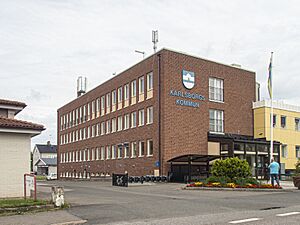
Karlsborg town hall
|
||
|
||
 |
||
| Country | Sweden | |
| County | Västra Götaland County | |
| Seat | Karlsborg | |
| Area | ||
| • Total | 801.48 km2 (309.45 sq mi) | |
| • Land | 407.99 km2 (157.53 sq mi) | |
| • Water | 393.49 km2 (151.93 sq mi) | |
| Area as of January 1, 2010. | ||
| Population
(June 30, 2012)
|
||
| • Total | 6,777 | |
| • Density | 8.4556/km2 (21.8999/sq mi) | |
| Time zone | UTC+1 (CET) | |
| • Summer (DST) | UTC+2 (CEST) | |
| ISO 3166 code | SE | |
| Province | Västergötland | |
| Municipal code | 1446 | |
| Website | www.karlsborg.se | |
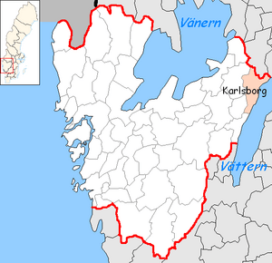
Karlsborg Municipality (which is Karlsborgs kommun in Swedish) is a special area in western Sweden. It's like a local government district. This municipality is located in Västra Götaland County. The main town and administrative center of the municipality is called Karlsborg.
This municipality was created in 1971. It was formed when the "old" Karlsborg area joined together with two other places, Mölltorp and Undenäs.
For many years, the area has been very important for military activities. This is mainly because of the famous Karlsborg Fortress.
Part of the beautiful Tiveden National Park is found within Karlsborg Municipality. This park is a great place to explore nature. You can also find the Flugebyn airfield here. This airfield is home to the Västergötland Skydiving Club, where people enjoy skydiving!
See also
 In Spanish: Municipio de Karlsborg para niños
 | Bayard Rustin |
 | Jeannette Carter |
 | Jeremiah A. Brown |


