Kashaweogama Lake (Ontario) facts for kids
Quick facts for kids Kashaweogama Lake |
|
|---|---|
| Location | Thunder Bay District, Ontario |
| Coordinates | 50°25′N 90°46′W / 50.417°N 90.767°W |
| Primary inflows | Wiggle Creek, Hough Creek |
| Primary outflows | Marchington River |
| Basin countries | Canada |
| Max. length | 18.4 km (11.4 mi) |
| Max. width | 1.3 km (0.8 mi) |
| Surface elevation | 390 m (1,280 ft) |
Kashaweogama Lake is a beautiful lake found in the Thunder Bay District in northwestern Ontario, Canada. It's an important part of the local water system. This lake is where the Marchington River begins its journey. A major road, Highway 599, passes right by the eastern side of the lake, making it easy to access.
Contents
Discover Kashaweogama Lake
Kashaweogama Lake is a natural body of fresh water. It is located in a large area of Canada known for its many lakes and forests. Lakes like Kashaweogama are often home to many types of plants and animals. They are also important for the environment and for people.
Where is Kashaweogama Lake Located?
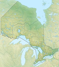
This lake is in the Thunder Bay District of Ontario. Ontario is a large province in Canada. The Thunder Bay District is in the northwestern part of Ontario. This area is known for its vast wilderness and many natural features. The lake's exact location can be found using its coordinates, which are like a special address on a map.
What are the Dimensions of Kashaweogama Lake?
Kashaweogama Lake is quite long and narrow. It stretches for about 18.4 kilometres (11.4 miles). At its widest point, the lake is about 1.3 kilometres (0.8 miles) across. This shape means it has a lot of shoreline, which can be interesting for exploring. The lake sits at an elevation of about 390 metres (1,280 feet) above sea level.
Water Flow: Inflows and Outflows
Lakes are often connected to other bodies of water. Water flows into them from rivers or streams, and then flows out into other rivers. This constant movement helps keep the lake healthy.
Which Rivers Flow into Kashaweogama Lake?
Two main streams feed water into Kashaweogama Lake. These are Wiggle Creek and Hough Creek. These creeks collect rainwater and melted snow from the surrounding land. They carry this fresh water into the lake, keeping its levels up.
Where Does Water Flow Out of Kashaweogama Lake?
Kashaweogama Lake is special because it is the "head" of the Marchington River. This means the Marchington River starts right here at the lake. Water from Kashaweogama Lake flows out and forms the beginning of this river. The Marchington River then continues its journey, carrying water away from the lake.
How Does Highway 599 Connect to the Lake?
Highway 599 is a provincial highway in Ontario. It runs very close to the eastern end of Kashaweogama Lake. Highways like this are important because they allow people to travel to and from remote areas. They also help connect communities and transport goods. Having a highway nearby makes the lake more accessible.
Why are Lakes Important?
Lakes like Kashaweogama are very important for many reasons. They provide homes for fish and other wildlife. They also play a role in the water cycle, storing fresh water. People often enjoy lakes for activities like fishing, boating, and simply enjoying nature. They are valuable natural resources that need to be protected.


