Keaau, Hawaii facts for kids
Quick facts for kids
Keaʻau, Hawaii
Keaʻau
|
|
|---|---|

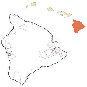
Location in Hawaiʻi County and the state of Hawaii
|
|
| Country | United States |
| State | Hawaii |
| County | Hawaiʻi |
| Area | |
| • Total | 6.27 sq mi (16.25 km2) |
| • Land | 6.27 sq mi (16.25 km2) |
| • Water | 0.00 sq mi (0.00 km2) |
| Elevation | 341 ft (104 m) |
| Population
(2020)
|
|
| • Total | 1,195 |
| • Density | 190.50/sq mi (73.56/km2) |
| Time zone | UTC-10 (Hawaii-Aleutian) |
| ZIP code |
96749
|
| Area code(s) | 808 |
| FIPS code | 15-32900 |
| GNIS feature ID | 0360892 |
Keaʻau, also known as Keaau, is a small community in Hawaiʻi County, Hawaii. It's located in the Puna District. Keaʻau is a census-designated place (CDP), which means it's an area identified by the U.S. Census Bureau for statistical purposes. In 2020, about 1,195 people lived there. This number was lower than in 2010, when the population was 2,253.
History of Keaʻau
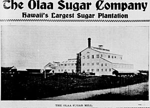
Long ago, Keaʻau was called ‘Ōla‘a. In 1899, a big company called the Olaa Sugar Company started operating here. They rented about 4,000 acres of land to grow sugarcane. This made sugar a very important part of the area's history.
Geography and Location
Keaʻau is found on the east side of the island of Hawaiʻi. Its exact location is 19°37′16″N 155°2′30″W / 19.62111°N 155.04167°W. It is next to Kurtistown to the southwest. The city of Hilo is about 8 miles (13 km) north of Keaʻau.
Two important roads meet in the northern part of Keaʻau: Hawaii Route 11 (the Hawaii Belt Road) and Hawaii Route 130 (Keaau-Pahoa Road). The U.S. Census Bureau says that Keaʻau covers about 6.7 square kilometers (2.6 square miles) of land. There is no water area within the community.
In 2003, the United States Board on Geographic Names officially named this populated place Keaʻau.
Population and People
| Historical population | |||
|---|---|---|---|
| Census | Pop. | %± | |
| 2020 | 1,195 | — | |
| U.S. Decennial Census | |||
The population of Keaʻau has changed over the years. In 2010, there were 2,253 people living in 701 homes. The population density was about 901 people per square mile (348 people per square kilometer).
In 2010, about 23.7% of the people were under 18 years old. About 17.2% were 65 years or older. The community had a good balance of males and females.
Places to Visit
- Hiʻiaka's Healing Herb Garden: A special garden where you can learn about traditional Hawaiian plants and their uses.
- Mauna Loa Macadamia Nut Corporation visitors center: This center is located between Hilo and Keaʻau. You can learn how macadamia nuts are grown and processed.
See also
 In Spanish: Keaau para niños


