
Kenhorst, Pennsylvania facts for kids
Quick facts for kids
Kenhorst, Pennsylvania
|
|
|---|---|

New Holland Rd., Kenhorst.
|
|

Location of Kenhorst in Berks County, Pennsylvania.
|
|

Kenhorst, Pennsylvania
Location in Pennsylvania

Kenhorst, Pennsylvania
Location in the United States
|
|
| Country | United States |
| State | Pennsylvania |
| County | Berks |
| Founded | August 25, 1931 |
| Area | |
| • Total | 0.59 sq mi (1.52 km2) |
| • Land | 0.59 sq mi (1.52 km2) |
| • Water | 0.00 sq mi (0.00 km2) |
| Elevation | 344 ft (105 m) |
| Population
(2020)
|
|
| • Total | 3,001 |
| • Density | 5,121.16/sq mi (1,976.89/km2) |
| Time zone | UTC-5 (EST) |
| • Summer (DST) | UTC-4 (EDT) |
| ZIP code |
19607
|
| Area codes | 610 and 484 |
| FIPS code | 42-39256 |
Kenhorst is a small town, called a borough, located in Berks County, Pennsylvania, in the United States. It was officially founded on August 25, 1931. In 2020, about 3,001 people lived there. The current mayor is Nickolas J. Hatzas.
Contents
Geography of Kenhorst
Kenhorst is in the middle of Berks County. It is next to the city of Reading to the north and east. To the south and west, it borders Cumru Township. This includes a small area called Grill.
The borough is quite small. It covers about 0.59 square miles (1.5 square kilometers) of land. There is no water area within its borders.
Transportation in Kenhorst
_at_South_Kenhorst_Boulevard_in_Kenhorst,_Berks_County,_Pennsylvania.jpg)
Kenhorst has a network of public roads. As of 2012, there were about 10.74 miles of roads. Most of these roads, about 9.13 miles, are taken care of by the borough itself. The remaining 1.61 miles are maintained by the Pennsylvania Department of Transportation (PennDOT).
Several important roads pass through or near Kenhorst:
- Pennsylvania Route 625 (also known as New Holland Road) runs north and south through the center of town.
- U.S. Route 222 Business (Lancaster Avenue) follows the northwest edge of the borough.
- Pennsylvania Route 724 (Philadelphia Avenue) runs along the south edge of Kenhorst.
Population Facts about Kenhorst
| Historical population | |||
|---|---|---|---|
| Census | Pop. | %± | |
| 1940 | 2,227 | — | |
| 1950 | 2,551 | 14.5% | |
| 1960 | 2,815 | 10.3% | |
| 1970 | 3,482 | 23.7% | |
| 1980 | 3,187 | −8.5% | |
| 1990 | 2,918 | −8.4% | |
| 2000 | 2,679 | −8.2% | |
| 2010 | 2,877 | 7.4% | |
| 2020 | 3,001 | 4.3% | |
| Sources: | |||
The population of Kenhorst has changed over the years. In 2000, there were 2,679 people living here. By 2020, the population grew to 3,001.
In 2000, there were 1,215 households in Kenhorst. A household is a group of people living together. About 22.2% of these households had children under 18. Many households, 53.9%, were married couples.
The age of people in Kenhorst varies. In 2000, about 18.4% of the population was under 18 years old. About 24.6% were 65 years or older. The average age in Kenhorst was 43 years old.
Gallery
-
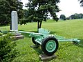
War Memorial in Kenhorst.
-
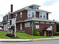
New Holland Rd.
-
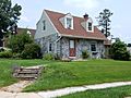
Lacrosse Ave.
-
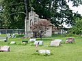
St. Stephen's Memorial Cemetery.
-
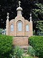
St. Nicolas Chapel at Memorial Cemetery.


See also
 In Spanish: Kenhorst para niños
