Keokea, Maui County, Hawaii facts for kids
Quick facts for kids
Keokea, Hawaii
Kēōkea
|
|
|---|---|
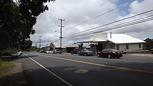
Main area of Keokea
|
|
| Country | United States |
| State | Hawaii |
| County | Maui |
| Area | |
| • Total | 18.35 sq mi (47.5 km2) |
| • Land | 18.35 sq mi (47.5 km2) |
| • Water | 0.0 sq mi (0 km2) |
| Elevation | 2,855 ft (870 m) |
| Population
(2020)
|
|
| • Total | 2,199 |
| • Density | 119.9/sq mi (46.3/km2) |
| Time zone | UTC-10 (Hawaii-Aleutian (HAST)) |
| • Summer (DST) | UTC-9 (HADT) |
| ZIP code |
96790 (Kula)
|
| FIPS code | 15-36050 |
| GNIS feature ID | 2583419 |
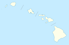
Keokea (which means "the white" in Hawaiian) is a small community in Hawaii. It's located on the island of Maui, which is part of Maui County.
This area is known as an unincorporated community. This means it doesn't have its own local government like a city or town. It's also a census-designated place (CDP), which is a special area defined by the U.S. Census Bureau for collecting population data.
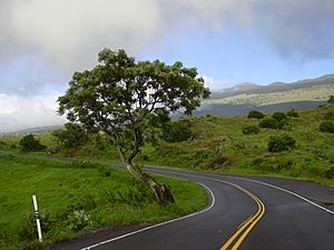
Keokea sits on Hawaii State Highway 37, also called the Kula Highway. It is about 2,860 feet (870 meters) above sea level. In 2020, about 2,199 people lived here. This was an increase from 1,612 people in 2010.
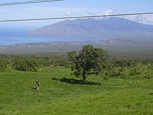
The land around Keokea is very good for farming and raising animals. This is because of its rich volcanic soil. The area also has a mild climate due to its high elevation. Tourism is another important part of the local economy.
The amount of rain changes a lot around Keokea. Lowlands nearby get less than 16 inches (410 mm) of rain each year. Higher areas get much more, up to 140 inches (3,600 mm). Keokea itself gets about 32 inches (810 mm) of rain annually.
Exploring Keokea's Location
Keokea is surrounded by interesting places on Maui. To the north, you'll find the community of Kula. To the southeast, there's the Kula Forest Preserve. This preserve goes up to a peak called Pu'ukeōkea, which is 7,051-foot (2,149 m) high.
If you travel northwest on Highway 37, you can reach Kahului. This larger town is about 21 miles (34 km) away from Keokea.
The U.S. Census Bureau says that the Keokea CDP covers an area of about 18.3 square miles (47 km2). All of this area is land, with no large bodies of water inside its borders.
See also
 In Spanish: Keokea (condado de Maui) para niños
 | William L. Dawson |
 | W. E. B. Du Bois |
 | Harry Belafonte |


