Kershope Burn facts for kids
Quick facts for kids Kershope Burn |
|
|---|---|

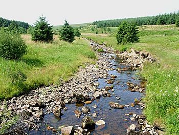
The burn near Scotch Kershope
|
|
|
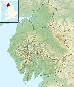
Location within Cumbria
|
|
| Country | United Kingdom |
| Part | England, Scotland |
| Physical characteristics | |
| River mouth | Liddel Water 55°08′17″N 2°49′26″W / 55.138069°N 2.823846°W |
The Kershope Burn is a small river, often called a 'burn' in Scotland. It flows entirely along the border between England and Scotland. This makes it a special natural landmark.
Contents
What is the Kershope Burn?
The Kershope Burn is a natural waterway. It acts as a clear line between two countries. Rivers like this are important for geography and history. They often play a role in how borders were decided long ago.
Where Does the Kershope Burn Start?
The journey of the Kershope Burn begins in a wet, marshy area. This place is called Hobb's Flow. It is found within Kielder Forest in Northumberland, England. At first, the burn is known as Clark's Sike. A "sike" is a small stream or ditch. It changes its name to Kershope Burn after flowing past a farmstead. This farm is called Kershopehead and is located in Cumbria, England.
Where Does the Kershope Burn End?
The Kershope Burn flows until it joins a larger river. This river is called Liddel Water. The meeting point is near a place called Kershopefoot. After the Kershope Burn joins it, Liddel Water continues to mark the border. It keeps the line between England and Scotland going. The very last part of the Kershope Burn flows past the small village of Kershopefoot. It also goes under an old railway bridge. This bridge was once part of the Waverley Line.
A Border River's History
The area around Kershope Burn has some interesting history. The railway bridge it flows under is a reminder of the past. From 1862 to 1969, there was a train station nearby. It was known as Kershope or Kershope Foot. This station served passengers for many years. It was an important stop on the Waverley Line. This line connected different towns and cities.
 | James B. Knighten |
 | Azellia White |
 | Willa Brown |


