Keweenaw Waterway facts for kids
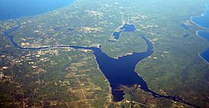
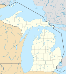
The Keweenaw Waterway is a special water path in Michigan. It's partly natural, like a river, and partly man-made, like a canal. This waterway cuts right through the Keweenaw Peninsula. It even separates a piece of land called Copper Island from the rest of Michigan. Different parts of this waterway have different names. These include the Portage Canal, Portage Lake, and Torch Lake. The waterway connects to Lake Superior at both its north and south ends. A main river, the Sturgeon River, flows into Portage Lake.
Contents
A Waterway with a Past
People started digging and expanding this waterway in the 1860s. Before that, local native people used a smaller river here. The big project was a team effort. The United States government worked with several mining companies. They wanted to make the waterway bigger.
Why the Waterway Was Built
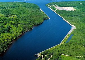
The main reason for the waterway was to help move copper. The Keweenaw Peninsula had many rich copper mines. Large ships called freighters could now carry copper from these mines. They would travel through the waterway and then out to Lake Superior. This helped get the copper to bigger cities.
The waterway also helped supply boats. These boats brought goods to the towns of Houghton and Hancock. These towns supplied most of Michigan's copper region. The expanded waterway is about 25 feet (7.6 meters) deep. In some spots, it's even deeper. Since the waterway connects Lake Superior to itself, no special water locks are needed.
Copper Island and the Bridge
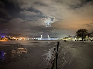
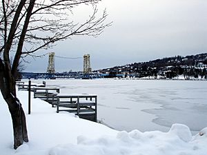
The area north of the waterway is known as Copper Island. This is because the waterway separates it from the rest of the mainland. The only way to cross the waterway by land is on US 41/M-26. This road goes over the Portage Lake Lift Bridge.
Fun Things to Do
The Keweenaw Waterway is part of the Keweenaw Water Trail. This trail is a special path for canoes and sea kayaks. It goes around and through the Keweenaw Peninsula. This means you can start and end in the same place. The trail was created in 1995. National Geographic Adventure Magazine even called it "A Superior Sports Port."
Exploring the Water Trail
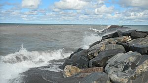
People say the trail truly shows what the Keweenaw Peninsula is like. The Lake Superior coastline here is rocky and interesting. It's even compared to Isle Royale, but you don't need a ferry to get there. You'll find wild areas and nature parks along the way. There are also safe harbors where tired paddlers can find a warm bed. They can also enjoy a hot meal and a shower at a local inn.
An average paddler can finish the whole route in six to eight days. But it's a good idea to plan extra days. This way, you're ready if strong winds keep you from paddling. Going all the way around Copper Island is becoming a top paddling spot in Michigan. You can also choose to do shorter trips if you prefer.
 | George Robert Carruthers |
 | Patricia Bath |
 | Jan Ernst Matzeliger |
 | Alexander Miles |


