Keysville, Virginia facts for kids
Quick facts for kids
Keysville, Virginia
|
|
|---|---|

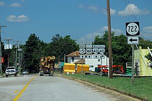
Entering Keysville from King Street
|
|

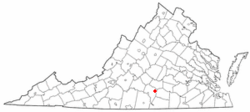
Location of Keysville, Virginia
|
|
| Country | United States |
| State | Virginia |
| County | Charlotte |
| Area | |
| • Total | 1.18 sq mi (3.05 km2) |
| • Land | 1.18 sq mi (3.05 km2) |
| • Water | 0.00 sq mi (0.00 km2) |
| Elevation | 676 ft (206 m) |
| Population
(2010)
|
|
| • Total | 832 |
| • Estimate
(2019)
|
781 |
| • Density | 664.12/sq mi (256.39/km2) |
| Time zone | UTC−5 (Eastern (EST)) |
| • Summer (DST) | UTC−4 (EDT) |
| ZIP code |
23947
|
| Area code | 434 |
| FIPS code | 51-42264 |
| GNIS feature ID | 1468986 |
Keysville is a small town in Charlotte County, Virginia, United States. In 2010, about 832 people lived there.
Keysville is home to one of the two campuses of Southside Virginia Community College. The area around the town is known for growing tobacco and other types of crops.
Contents
Exploring Keysville's Location
Keysville is located in the eastern part of Charlotte County. Major roads like U.S. Route 15 and U.S. Route 360 are on its eastern side. These are four-lane highways. Virginia State Route 40 also runs through the middle of the town.
You can travel north on US 15 for about 20 miles to reach Farmville. US 360 goes northeast for about 20 miles to Burkeville. If you go southwest, both routes lead to Wylliesburg, which is about 15 miles away. Route 40 heads east for 18 miles to Victoria and west for 9 miles to Charlotte Court House.
The United States Census Bureau says that Keysville covers an area of about 3.0 square kilometers (or 1.18 square miles). All of this area is land.
Keysville's Population Over Time
| Historical population | |||
|---|---|---|---|
| Census | Pop. | %± | |
| 1880 | 115 | — | |
| 1890 | 126 | 9.6% | |
| 1900 | 82 | −34.9% | |
| 1910 | 482 | 487.8% | |
| 1920 | 493 | 2.3% | |
| 1930 | 589 | 19.5% | |
| 1940 | 607 | 3.1% | |
| 1950 | 690 | 13.7% | |
| 1960 | 733 | 6.2% | |
| 1970 | 818 | 11.6% | |
| 1980 | 704 | −13.9% | |
| 1990 | 606 | −13.9% | |
| 2000 | 817 | 34.8% | |
| 2010 | 832 | 1.8% | |
| 2019 (est.) | 781 | −6.1% | |
| U.S. Decennial Census | |||
In 2000, there were 817 people living in Keysville. These people lived in 359 households. The town had a population density of about 694 people per square mile.
The population was made up of different groups. About 64.75% were White, and 33.54% were African American. A small number of people were Asian or from other backgrounds. About 1.10% of the population was Hispanic or Latino.
The average age of people in Keysville was 45 years old. About 20.7% of the population was under 18 years old. Around 30.1% of the people were 65 years or older.
Improving Keysville's Future
Keysville has been part of efforts to bring new technology to rural areas. One important project was setting up a special internet connection using optical fiber between Farmville and Keysville. This was the first step in a plan by Governor Mark Warner to bring fast internet to countryside areas in Virginia.
This project was paid for by the Tobacco Indemnification Fund. It also aimed to help the Southside Industrial Park grow. By having good internet, mid-sized businesses could move there. This would bring more jobs and industry to Charlotte County. The internet link is now ready, but it is still waiting to be fully used.
See also
In Spanish: Keysville (Virginia) for kids

