Quick facts for kids
King Island
 |
Location in Sacramento-San Joaquin River Delta
Show map of Sacramento-San Joaquin River Delta
Location in California
Show map of California
Location in the United States
Show map of the United States
|
| Geography |
| Location |
Northern California |
| Coordinates |
38°03′56″N 121°26′12″W / 38.065476°N 121.436617°W / 38.065476; -121.436617 |
| Adjacent bodies of water |
Sacramento-San Joaquin River Delta |
| Area |
3,200 acres (1,300 ha) |
| Administration |
|
|
| State |
 California California |
| County |
San Joaquin |
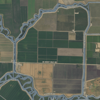
King Island is an island in the northern part of the Sacramento-San Joaquin River Delta in California. It is located about twenty kilometers (about 12 miles) east of Antioch and twenty kilometers west of Stockton.
About King Island
King Island is a fairly large island, covering about 1,300 hectares (which is about 3,200 acres). To give you an idea, that's roughly the size of 2,400 football fields!
Where is King Island?
This island is found in San Joaquin County. It is surrounded by different waterways that help define its shape:
- To the north, you'll find White Slough.
- To the east, there's Bishop Cut.
- To the south, it's bordered by Disappointment Slough.
- And to the west, you'll see Honker Cut.
Who Manages the Island?
King Island is managed by something called a Reclamation District. A Reclamation District is a special local government group that helps manage land, especially in areas like the Delta where water levels need to be controlled. They often work on things like levees (walls that keep water out) and drainage systems. King Island is looked after by Reclamation District 2044.


