Kings Causeway Branch facts for kids
Quick facts for kids Kings Causeway Branch |
|
|---|---|
|
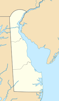
Location of Kings Causeway Branch mouth
|
|
| Other name(s) | Tributary to Mispillion River |
| Country | United States |
| State | Delaware |
| County | Kent |
| Physical characteristics | |
| Main source | Brockonbridge Gut divide about 0.5 miles west of Scotts Corners, Delaware 7 ft (2.1 m) 38°59′34″N 075°23′24″W / 38.99278°N 75.39000°W |
| River mouth | Mispillion River about 2.5 miles southeast of Herrings Corners, Delaware 0 ft (0 m) 38°57′39″N 075°22′40″W / 38.96083°N 75.37778°W |
| Length | 2.43 mi (3.91 km) |
| Basin features | |
| Progression | south |
| River system | Mispillion River |
| Basin size | 1.96 square miles (5.1 km2) |
| Tributaries |
|
| Bridges | Big Stone Beach Road, Stratham Lane |
Kings Causeway Branch is a small stream, about 2.43 miles (3.91 kilometers) long, located in Kent County, Delaware. It's like a small helper stream, also known as a "tributary," that flows into a bigger river called the Mispillion River.
Contents
Kings Causeway Branch Stream
Kings Causeway Branch is considered a "first-order" stream. This means it's one of the smallest types of streams and doesn't have any smaller streams flowing into it.
Where the Stream Starts and Ends
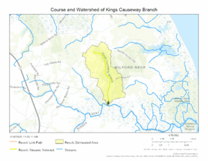
Kings Causeway Branch begins in an area called the Brockonbridge Gut divide. This is about half a mile (0.8 kilometers) west of a place called Scotts Corners in Delaware.
From there, the stream flows south. It travels for about 2.5 miles (4.0 kilometers) before it joins the Mispillion River. This meeting point is about 2.5 miles southeast of Herrings Corners, Delaware.
The Area Around the Stream
The land that drains into Kings Causeway Branch is called its watershed. This watershed covers about 1.96 square miles (5.08 square kilometers).
Each year, this area gets about 45.3 inches (115 centimeters) of rain and other types of precipitation. About 4.8% of the land in the watershed is covered by forests.
Maps
 | Ernest Everett Just |
 | Mary Jackson |
 | Emmett Chappelle |
 | Marie Maynard Daly |


