Mispillion River facts for kids
Quick facts for kids Mispillion River |
|
|---|---|

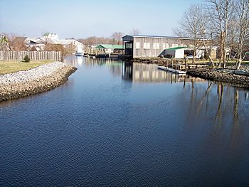
The Mispillion River in Milford in 2006
|
|
|
Location of the mouth of the Mispillion River
|
|
| Country | United States |
| State | Delaware |
| Counties | Kent Sussex |
| Physical characteristics | |
| Main source | confluence of Beaverdam and Tantrough Branches at Blairs Pond near Milford 29 ft (8.8 m) 38°52′53″N 75°30′00″W / 38.88139°N 75.50000°W |
| River mouth | Delaware Bay near Mispillion Light 0 ft (0 m) 38°57′05″N 75°18′48″W / 38.95139°N 75.31333°W |
| Length | 15 mi (24 km)approximately |
| Basin features | |
| Progression | east and northeast |
| River system | Delaware Bay |
| Basin size | 76 sq mi (200 km2) |
| Tributaries |
|
| Waterbodies | Blairs Pond Griffith Lake Haven Lake Silver Lake |
The Mispillion River is a cool river in southern Delaware, United States. It flows into the Delaware Bay. This river is about 15 miles (24 km) long. It helps drain an area of 76 square miles (197 km²). This area is part of the Atlantic coastal plain.
The river starts in northern Sussex County. This is about 3 miles (5 km) southwest of Milford. It then flows generally east-northeast. The river forms the border between Sussex and Kent counties. It even goes right through the middle of Milford. Finally, it reaches its mouth at Delaware Bay. This spot is 16 miles (26 km) northwest of Cape Henlopen.
The lower 12 miles (19 km) of the river are considered navigable. This means boats can travel on this part of the river. The United States Army Corps of Engineers helps keep it clear for boats.
Exploring the Mispillion Riverwalk
A fun place to visit along the river is the Mispillion Riverwalk. This is a boardwalk that follows the river in Milford. It's a great spot for walking and enjoying nature.
Around 2003, people started working on a special project. They wanted to protect a "greenway" along the river. A greenway is like a natural path or corridor. It helps keep the area around the river wild and beautiful. This effort focused on areas both upstream and downstream of Milford.
Understanding the River's Name
The Mispillion River has had many different names over time. The Geographic Names Information System keeps track of these historical names. Some of them include:
- Masphilion Creek
- Maspillon Creek
- Mispalling Creek
- Mispelion Creek
- Mispelon Creek
- Mispening Creek
- Miss Pinion River
- Mispeninge Creek
- Misperange River
- Mispilian Creek
- Mispliant Creek
- Misspann Creek
- Muskmellon Creek
- Musmillion River
- Musphilion Creek
- Muspilion Creek
The very first time this river's name was written down was in 1664. It appeared as "Mispening" on a map. Experts believe this name might mean "as the great tuber (stream)." This suggests it refers to the river being a significant waterway.
 | Ernest Everett Just |
 | Mary Jackson |
 | Emmett Chappelle |
 | Marie Maynard Daly |


