Cape Henlopen facts for kids
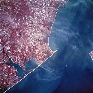
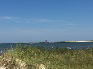
Cape Henlopen is a special piece of land at the southern end of Delaware Bay on the Atlantic Ocean coast of the United States. It's located in the state of Delaware, close to the town of Lewes. This is where the waters of the Delaware Bay meet the big Atlantic Ocean. If you look out from the coast on the bay side, you can spot two lighthouses: the Harbor of Refuge Light and the Delaware Breakwater East End Light.
Contents
A Look Back in Time
Cape Henlopen was first called Cape Hinlopen. It was named after a Dutch trader named Thijmen Jacobsz Hinlopen. Long ago, this cape marked the southernmost edge of a Dutch territory called New Netherland.
Early Explorers and Settlers
In the early 1600s, Dutch explorers like Cornelis Jacobsz Mey and Cornelis Hendricksz explored this area. They sailed ships like the "Good News" and "Bever" to trade with Native Americans along the Delaware River. They were trying to claim this land for the Netherlands. Later, in 1624, the Dutch West India Company sent the first settlers to New Netherland, helping to make it an official province.
A Battle During the Revolution
In 1782, during the American Revolutionary War, a young American naval officer named Joshua Barney led a small group of ships. They fought a battle against British ships near Cape May and Delaware Bay. Even though the Americans had fewer ships, they managed to defeat the British. This battle ended with two British ships being lost.
Cape Henlopen State Park: Fun and Nature
Cape Henlopen is home to a large and beautiful place called Cape Henlopen State Park. It covers about 5,193 acres (21 square kilometers). Back in 1682, William Penn, who founded Pennsylvania, made the beaches of Cape Henlopen one of the very first public lands in what would become the United States. He said it was for "the usage of the citizens of Lewes and Sussex County."
Things to Do at the Park
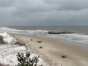
Cape Henlopen State Park is open all year round and has a fishing pier that's open 24 hours a day. There are also places for camping. Other parts of the park are open from sunrise to sunset. You can find a bathhouse on the Atlantic Ocean side, a spot for surf-fishing, and even a disc golf course. There are also paths for biking and walking. You can even visit a World War II-era watchtower that's open to the public. The beach at Herring Point is also a popular place for surfing!
Cape Henlopen is also the starting point for the American Discovery Trail. This is the only hiking trail in the United States that goes all the way from one coast to the other!
Important Moments in Cape Henlopen's History
Here are some key events that happened at Cape Henlopen:
- 1682: William Penn sets aside the area as public land for everyone to use.
- 1767-1769: The Cape Henlopen Lighthouse is built on the Great Dune. It was the sixth lighthouse ever built in America!
- 1784: The Cape Henlopen Lighthouse is fixed after a fire and starts working again.
- 1926: The Cape Henlopen Lighthouse falls down because the Great Dune it was on moved.
- 1941: The U.S. Army builds Fort Miles at Cape Henlopen during World War II.
- 1964: The U.S. Department of Defense gives 543 acres (2.2 square kilometers) of land to Delaware. This is when Cape Henlopen State Park is officially created.
- 1997: The State of Delaware buys the East End lighthouse and adds it to the National Register of Historic Places.
 | Georgia Louise Harris Brown |
 | Julian Abele |
 | Norma Merrick Sklarek |
 | William Sidney Pittman |


