Kings Run (Ararat River tributary) facts for kids
Quick facts for kids Kings Run |
|
|---|---|
|
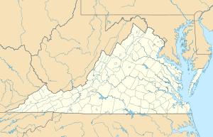
Location of Kings Run mouth
|
|
| Other name(s) | Tributary to Ararat River |
| Country | United States |
| State | Virginia |
| County | Patrick |
| Physical characteristics | |
| Main source | unnamed tributary to Pine Creek divide about 0.1 miles southwest of Groundhog Mountain 2,720 ft (830 m) 36°38′29″N 080°31′54″W / 36.64139°N 80.53167°W |
| River mouth | Ararat River about 0.5 miles northwest of Ararat, Virginia 1,275 ft (389 m) 36°35′26″N 080°32′54″W / 36.59056°N 80.54833°W |
| Length | 2.59 mi (4.17 km) |
| Basin features | |
| Progression | south |
| River system | Yadkin River |
| Basin size | 1.47 square miles (3.8 km2) |
| Tributaries |
|
| Bridges | Raven Rock Road, Spring Branch Road |
Kings Run is a small stream, about 2.59 miles (4.17 km) long. It flows into the Ararat River in Patrick County, Virginia. Kings Run is considered a "first-order tributary." This means it is a small stream that does not have any smaller streams flowing into it.
Contents
The Journey of Kings Run
Kings Run begins in Patrick County, Virginia. It starts near a place called Groundhog Mountain. The stream's source is about 0.1 miles southwest of the mountain.
Where Kings Run Flows
From its starting point, Kings Run flows generally south. It travels through the landscape of Patrick County. The stream eventually reaches the Ararat River. This meeting point is about 0.5 miles northwest of a town called Ararat, Virginia.
Bridges Over Kings Run
Two roads cross over Kings Run. These are Raven Rock Road and Spring Branch Road. These bridges help people travel easily across the stream.
The Kings Run Watershed
A watershed is an area of land where all the water drains into a single stream or river. The Kings Run watershed covers about 1.47 square miles (3.81 square kilometers).
Water and Land in the Watershed
This area receives a good amount of rain each year. On average, it gets about 53.9 inches (137 cm) of precipitation annually. A large part of the Kings Run watershed is covered by forests. About 70% of the land here is forested. This means there are many trees and natural areas.
 | Audre Lorde |
 | John Berry Meachum |
 | Ferdinand Lee Barnett |


