Kinnerly Peak facts for kids
Quick facts for kids Kinnerly Peak |
|
|---|---|
 |
|
| Highest point | |
| Elevation | 9,949 ft (3,032 m) NAVD 88 |
| Prominence | 1,465 ft (447 m) |
| Geography | |
| Parent range | Livingston Range |
| Topo map | USGS Kintla Peak, MT |
| Climbing | |
| First ascent | 1937 by Norman Clyde, Ed Hall, Richard K. Hill and Braeme Gigos |
| Easiest route | class 4 or easy Class 5 |
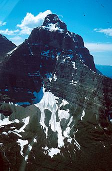
Kinnerly Peak is a tall mountain located in Glacier National Park in Montana, U.S.. It reaches a height of 9,949 ft (3,032 m) (about 3,032 meters). This impressive peak is part of the Livingston Range. It's famous for its huge north side, which rises sharply from a beautiful lake below. Kinnerly Peak is the eighth tallest mountain in all of Glacier National Park.
Contents
Where is Kinnerly Peak Located?
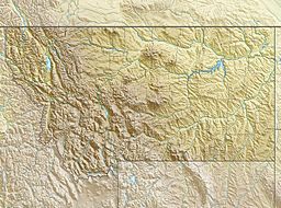
Kinnerly Peak is found in a quiet, far-off part of Glacier National Park. It is about 1 mile (1.6 km) north of Kintla Peak. Kintla Peak is the highest mountain in the Livingston Range. Kinnerly Peak is also about 3 miles (4.8 km) south of the border between Canada and the United States.
The Impressive North Face
One of the most special things about Kinnerly Peak is its massive north face. This side of the mountain rises very steeply from Upper Kintla Lake. Imagine climbing from the lake all the way to the top! That's an elevation gain of 5,573 feet (1,699 m) in a horizontal distance of only about 1 mile (1.6 km). This makes it a truly dramatic and challenging climb.
First Climbers of Kinnerly Peak
The first time anyone officially climbed Kinnerly Peak was in 1937. A group from the Sierra Club made this first ascent. They were led by a well-known mountaineer named Norman Clyde.
Climbing Routes
The most common way to climb Kinnerly Peak is up its northwest face. This route usually starts from the south shore of Upper Kintla Lake. Climbers have to gain a lot of height, mostly by scrambling. Scrambling means climbing over rocks and steep ground using both your hands and feet. Some parts of the climb are a bit tricky and exposed. This means there might be steep drops nearby. These sections are rated as "Class 4 or easy Class 5." This is a way to describe how difficult a climb is. There are also other climbing paths on the southeast and southwest sides of the mountain.
 | Misty Copeland |
 | Raven Wilkinson |
 | Debra Austin |
 | Aesha Ash |


