Kinnickinnic River (Milwaukee River tributary) facts for kids
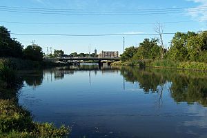
The Kinnickinnic River is one of three main rivers that flow into the Milwaukee harbor in Wisconsin. It joins the Menomonee River and Milwaukee River before emptying into Lake Michigan. People in the area often call it the "KK River".
The name Kinnickinnic comes from the Ojibwe language. It means "what is mixed," referring to a mix of native plants and tobaccos. Even though it's the smallest river in the Milwaukee River Basin, it flows through very busy city areas. This includes the Lincoln Village neighborhood and a heavily industrial part of the harbor.
Contents
History of the Kinnickinnic River
Milwaukee was built in a place with a natural harbor. This harbor was formed where three rivers met before flowing into Lake Michigan. The Kinnickinnic River is the southernmost of these three rivers. It flows mostly northeast towards the harbor. The Menomonee River comes from the west, and the Milwaukee River from the north.
How the Harbor Changed
Long ago, the Kinnickinnic River flowed almost directly into Lake Michigan. The Milwaukee and Menomonee rivers flowed south from the city center before reaching the lake. A long, marshy strip of land, called Jones Island, protected the harbor. This strip of land stretched south from the city.
To make it easier for ships to get to the city, a "straight cut" was made across the top of Jones Island. This new cut became the main entrance to the harbor. The old harbor entrance was then filled in. This made Jones Island a peninsula that stretched north, with its base to the south. This change actually made the river seem longer, and this new part became a big section of the harbor.
Fishing and Industry
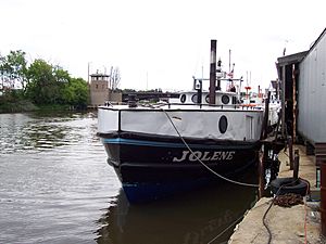
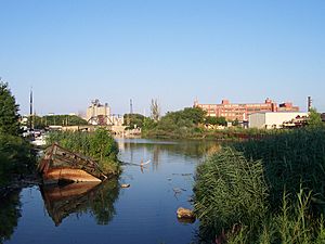
Over time, the "inner" harbor, formed by the three rivers, became too small for all the ships. So, an "outer" harbor was built in Lake Michigan. The side of Jones Island facing the lake became a docking area. People who lived on Jones Island had to move. Many small commercial fishermen moved their operations further up the Kinnickinnic River. Today, you can still see commercial fishing boats and small pleasure boats near the 1st Street Bridge.
Concrete River Banks
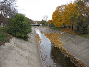
Upstream, near the I-94/43 highway, the river banks are lined with concrete. This concrete was put in during the 1960s. The idea was to stop flooding in the neighborhoods nearby. However, even with the concrete, flooding still happens. The water in the concrete channel can also flow extremely fast.
About the Kinnickinnic River
River Area and People
The Kinnickinnic River is about 9.6 miles (15.4 km) long. Its watershed, which is the area of land that drains into the river, covers about 25 square miles (65 km²). Many of the smaller streams that flow into the river have also been changed with concrete channels. Around 145,000 people live in this watershed, making it the most crowded river area in the region. Most of the land in the watershed is developed, meaning it's covered by buildings and roads.
Because of high pollution, limited public access, and a lack of plants along its banks, many people see the river as just a drainage system for city waste.
The river's mouth, where it meets the lake, flows into Lake Michigan at the Milwaukee harbor. It joins the Milwaukee River and Menomonee River there.
Pollution Challenges
The lowest part of the Kinnickinnic River is part of the Milwaukee Estuary Area of Concern. This is one of the Great Lakes Areas of Concern, which are places with serious environmental problems. In the Kinnickinnic, this is because of high levels of harmful chemicals like PCBs and PAHs found in the river. Because of these problems, in 2007, the Kinnickinnic was named the 7th most endangered river in the U.S. by American Rivers.
Making the River Better
There are plans and ongoing projects to improve the river. In the fall of 2009, workers removed 167,000 cubic yards (127,700 m³) of dirt and mud from the river near the harbor. This mud was full of PCBs and PAHs. Removing it helped the environment and made the river safer and deeper for boats.
Plans are also underway to remove the concrete from the river channel. This is part of a project led by the Milwaukee Metropolitan Sewerage District (MMSD) to help prevent floods. A new river path will be created to handle heavy rainfall, slow down the water, and return the river to a more natural state. This will also create green spaces for people to enjoy and allow fish and other water creatures to move freely.
In 2009, a neighborhood plan was created to improve the area around the river. This plan uses the flood control work as a starting point. Besides the river itself, the plan also focuses on nearby parks, open spaces, homes, businesses, transportation, and learning opportunities.
 | Tommie Smith |
 | Simone Manuel |
 | Shani Davis |
 | Simone Biles |
 | Alice Coachman |


