Kintore, Northern Territory facts for kids
Quick facts for kids KintoreWalungurru Northern Territory |
|||||||||||||||
|---|---|---|---|---|---|---|---|---|---|---|---|---|---|---|---|
| Population | 410 (2016 census) | ||||||||||||||
| • Density | 50.0/km2 (129/sq mi) | ||||||||||||||
| Established | 1981 | ||||||||||||||
| Postcode(s) | 0872 | ||||||||||||||
| Elevation | 454 m (1,490 ft)(weather station) | ||||||||||||||
| Area | 8.2 km2 (3.2 sq mi) | ||||||||||||||
| Time zone | ACST (UTC+9:30) | ||||||||||||||
| Location |
|
||||||||||||||
| LGA(s) | MacDonnell Region | ||||||||||||||
| Territory electorate(s) | Namatjira | ||||||||||||||
| Federal Division(s) | Lingiari | ||||||||||||||
|
|||||||||||||||
|
|||||||||||||||
| Footnotes | Locations Adjoining localities |
||||||||||||||
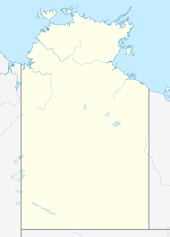
Kintore, also known as Walungurru in the Pintupi language, is a small, remote town in the Northern Territory of Australia. It is about 530 kilometres (330 mi) west of Alice Springs. The town is very close to the border with Western Australia. Kintore is also called Walungurru, Walangkura, and Walangura.
Contents
History of Kintore
The area around Kintore is called the Kintore Range. It was named in 1889 by an explorer named William Tietkens. He named it after the Governor of South Australia at the time, Algernon Keith-Falconer, 9th Earl of Kintore.
In the late 1970s and early 1980s, good water sources were found near the Kintore Range. This led to the establishment of Kintore as a community in 1981. Many Pintupi people had been living in Papunya, another community. However, they wanted to return to their traditional lands. They had been forced to leave their homes many years before due to rocket testing in a different part of Australia. Kintore became a place where they could reconnect with their ancestral country. This movement of people returning to their homelands is called the "outstation movement."
People and Languages
At the 2016 census, Kintore had a population of 410 people. Most of the people living there, about 92%, identified as Aboriginal Australians.
The main languages spoken in Kintore are Pintupi and Luritja. Pintupi is the most common language in the community. In Pintupi, Kintore is known as Walungurru.
How Kintore is Governed
Kintore is managed by the MacDonnell Regional Council. This council is based in Alice Springs.
For government elections, Kintore is part of the Gwoja area for the Northern Territory. It is also part of the Lingiari area for federal elections in Australia.
Community Facilities
The Kintore community has several important facilities. These include a primary school funded by the Northern Territory Government. There is also an independent store called Puli Kutjarra, which means "Two Rocks/mountains" in Pintupi.
Other facilities include an airstrip and an independent health clinic called Pintupi Homelands Health Service. There is also a women's centre called Ngintaka Women's Centre. The Purple House offers haemodialysis services, which help people with kidney problems. A high school program is run by Yirara College.
The local Australian rules football team is known as the Kintore Hawks.
Art Centre
Kintore is a very important place for the Western Desert art movement. This art style started in the community of Papunya. Traditionally, the Pintupi people shared important Dreamtime stories through art. They used materials like sand, rocks, and local plants.
Today, these beautiful paintings are often done on canvas. They have become very popular all over the world. Many artists from the famous Aboriginal art company Papunya Tula live in Kintore. One well-known artist who lived there was Ningura Napurrula.
Climate
| Climate data for Kintore (Walungurru Airport), elevation 454 m (1,490 ft) | |||||||||||||
|---|---|---|---|---|---|---|---|---|---|---|---|---|---|
| Month | Jan | Feb | Mar | Apr | May | Jun | Jul | Aug | Sep | Oct | Nov | Dec | Year |
| Record high °C (°F) | 47.4 (117.3) |
46.4 (115.5) |
44.4 (111.9) |
41.1 (106.0) |
34.9 (94.8) |
32.8 (91.0) |
32.3 (90.1) |
35.0 (95.0) |
39.0 (102.2) |
43.0 (109.4) |
45.3 (113.5) |
47.7 (117.9) |
47.7 (117.9) |
| Mean daily maximum °C (°F) | 39.4 (102.9) |
38.8 (101.8) |
36.7 (98.1) |
33.0 (91.4) |
27.2 (81.0) |
23.3 (73.9) |
23.9 (75.0) |
26.8 (80.2) |
31.8 (89.2) |
35.8 (96.4) |
37.3 (99.1) |
38.5 (101.3) |
32.7 (90.9) |
| Mean daily minimum °C (°F) | 26.3 (79.3) |
25.9 (78.6) |
24.5 (76.1) |
20.5 (68.9) |
15.3 (59.5) |
11.2 (52.2) |
10.8 (51.4) |
12.6 (54.7) |
16.9 (62.4) |
20.9 (69.6) |
23.1 (73.6) |
25.1 (77.2) |
19.4 (66.9) |
| Record low °C (°F) | 16.1 (61.0) |
18.0 (64.4) |
13.7 (56.7) |
11.6 (52.9) |
6.2 (43.2) |
2.4 (36.3) |
3.1 (37.6) |
3.3 (37.9) |
8.3 (46.9) |
8.9 (48.0) |
10.4 (50.7) |
14.3 (57.7) |
2.4 (36.3) |
| Average rainfall mm (inches) | 54.0 (2.13) |
31.2 (1.23) |
45.2 (1.78) |
13.1 (0.52) |
15.4 (0.61) |
13.1 (0.52) |
9.9 (0.39) |
4.7 (0.19) |
6.7 (0.26) |
14.0 (0.55) |
24.1 (0.95) |
54.9 (2.16) |
289.1 (11.38) |
| Average rainy days (≥ 1.0 mm) | 5.3 | 3.0 | 3.5 | 0.9 | 1.3 | 1.2 | 1.0 | 0.5 | 0.8 | 1.7 | 3.3 | 4.7 | 27.2 |
| Source: Australian Bureau of Meteorology | |||||||||||||
See also
 In Spanish: Kintore (Australia) para niños
 | Emma Amos |
 | Edward Mitchell Bannister |
 | Larry D. Alexander |
 | Ernie Barnes |


